Wisconsin White River Trail and Kenosha Trail Rides

Well I have been putting in some bike miles for this season but have not had a lot of time to update the about-bicycles blog here with all the latest… Until Now!

I am writing this article to let you know about some Southern Wisconsin Bike Trails that I have just discovered or trails that I have ridden in the past and for which I have just now posting the photos and ride reports.

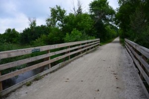
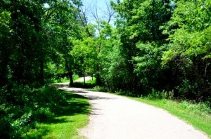
White River Trail Bridge

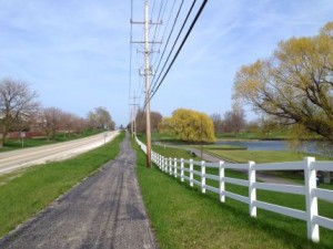
White River Trail and the bridge over the White River

The first trail that I would like to mention is the White River Trail (WRT)  that heads east and west out of Burlington, Wisconsin. Both sections of this trail go into Burlington but they do not actually connect to each other although you could probably find a way to get from one to the other through the town of Burlington.

You can, however connect to the Seven Waters Trail (SWT) which heads northeast out of Burlington from the East Leg of the WRT. I did not get a chance to ride the SWT but we did ride both sides of the WRT just last month (June 2015).

This was a 38 mile ride and you can find all the details here on the new White River Trail pages. You will find the first-hand ride report, maps and photos of scenes along the trail on these new trail pages.

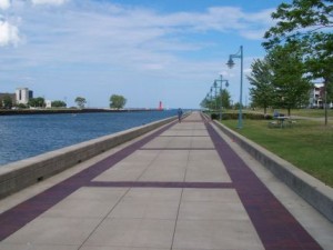
Kenosha Bike Trail

Kenosha Bike Trail on Lake Michigan

Next, I would like to let you know about the new trail pages that I just posted for our ride on the Kenosha Bike Trail (KBT) and Pike Bike Trail (PBT) in Kenosha, Wis.These are some nice bike trails along Lake Michigan just over the Wisconsin border.

We actually rode these trail in July of 2010 and I took a batch of photos but kind of forgot to upload the photos and ride report for this one :-(. So sorry, this ride is from a few years back but it was a very nice ride back then and I’m sure it still is. I would like to ride this one again and continue on to some of the connecting trails.

You can find our ride report and photos for The Kenosha Bike Trails here.

So if you are looking for some nice Wisconsin Bike trails within easy driving distrance from the Chicagoland area, these are a couple of good options.

Like the old cowboy used to say… Happy Trails to You ♫ …

Heart-Rate Settings on the Garmin 800

The first thing that I planned on mentioning here is simply that the settings for Heart-Rate Zones in the Garmin 800 GPS Bike computer are not where you might expect them to be.

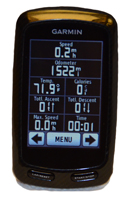
Garmin Edge 800

Garmin Edge 800

I have had my Garmin 800 GPS unit for a couple of years now and have not reset the heart-rate zones since I got it. Well, since these zones are mostly based on age I knew that they were out of date and decided to reset them.

I’m sure this information is in the manual somewhere and I obviously had checked that when I first set it but it is NOT intuitive and was not where I expected it to be.

It seemed logical to me that you would set the heart-rate zones in the > User Profile section but that is not where you make the setting. You actually change the heart-rate settings in > Bike Settings (then down arrow) > Heart Rate.

The User Profile includes Gender, Age, Weight, Height and Activity Class. Since I could not find the heart-rate setting at first I thought that changing these parameters might change your heart-rate zones (seemed logical to me anyway).

So I made some changes here and went out for a ride to check my new 90% workout zone. I expected a change since I changed my age and activity class (from 45 min workout time a week to 1 to 3 hours per week which is much closer for me (if not even a little low).

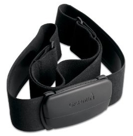
HR Monitor

HR Strap

Next I go out to my first hill and push myself up to the 90% zone and check my heart-rate. Well, it was exactly the same as it was before. So just to check the settings I set my User profile to a 20 Year old, 150 lbs and workout time of over 15 hours a week!

So I find the next hill and start racing again to get my heart-rate up. No change… Well I tried resetting the trip setting then turning the unit off completely and on again… Another hill… another 90%+ heart-rate… No change!!!

OK, I finally decided that this information made no difference in the unit’s heart-rate zones and was totally exhausted after my ride.

BTW: You can set the heart-rate zones as I described above but the only way to see where how they are actually set (the heart-beat rates) you need to go out and ride and see what happens.

Anyway, when you track down where to make the heart-rate changes ~ under > Bike Settings (then down arrow) > Heart Rate > Heart Rate Zones. ~ you can set your Maximum HR, Resting HR and the method that you want to use to calculate the rates for each zone.

This lead me into a little more research on calculating Maximum Heart-Rate and decided to change my calculation from the easy and popular method (220 – your age) to what I believe may be a little more accurate formula that I found on the Wikipedia Heart Rate page.

I am now using the Robergs and Landwehr method where: HRmax = 205.8 − (0.685 × age)

They say you really need to do a Stress Test to get an accurate Max HR but, since I am not going to go out and pay for a stress test just to get my max hr, I like the method above since it yields a little higher ranges (than the 220-age method) and I think that fits me a little better.

When I originally got my Edge 800 I mostly wanted to upgrade my bike computer and even thought that the navigation would be really cool. I wasn’t that interested in the Heart-Rate monitor but I have since found this to be one of the features that I use the most with this unit.

I still love this GPS bike computer and all of its features. For a little more information specifically on the Edge 800 see our Garmin Edge 800 page on this site.


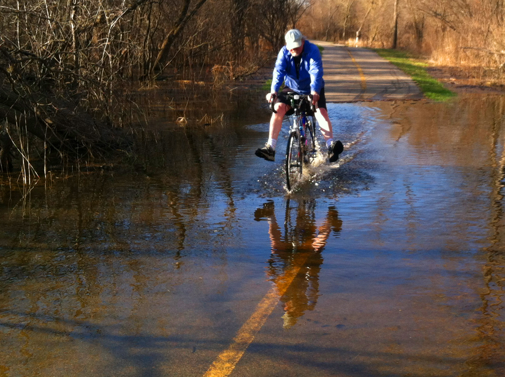
Flooding on the Paul Douglas Trail in the Usual Place

We have had enough nice days here in the Chicagoland area to get out and start accumulating some bike miles now. I only have a little over 100 miles for this season myself and have only been out on my local trails so far this year.

Riding through the flood in Paul Douglas Preserve

Riding the Flood Out

Speaking of local trails, I have ridden the trail through the Paul Douglas Preserve a few times this year and as of yesterday there was some flooding again in the usual place, in the stretch that runs along side of Hunting Freeman Road.

I did not have my DSLR camera with me but my wife and I had our phones, as usual, of course, so I figured I would get some photos of the flood and my wife even got some shots of me riding through the flooded area. It was only about 6 inches deep and I was having a little fun (keeping my feet out of the water in the photo above).

Keeping feet dry pedaling through flooded trail

Keeping my feet dry another way

You could actually ride through the flooded area, without getting your feet wet if you did it the right way, as I did in the next photo. If you do not have a long distance to go through the flood you can keep both pedals mostly parallel to the ground and just do short, partial pedal strokes going back and forth (pedaling a little forward then a little back, then a little forward again, etc…). It works for a short distance and is better than doing full strokes and totally submerging your feet in the water (assuming you want to stay dry). I also noticed that this works best in a little higher gear.

There were a few other wet places on the trail but you could just ride around the water in the other places. Other than that the trail was in pretty good condition.

There were a few places where there was a lot of gravel debris where the trail is close to the roads and the snow was plowed on to the trail and a some small branches and sticks in the trail.

I did my duty and cleared a few larger branches off of the trail where the trail turns at Central and Roselle Roads.

For more information on many of the trails in our area, see our main Bike Trails page. You can also browse this blog using the “Bike Trail Conditions” Category of just use the local search to find the trail that you are interested in.

As usual, enjoy the ride!

The Old School and Des Plaines River Trails

I rode the Des Plaines River Trail (DPRT) once again last month and this time I brought my camera and explored some of the trails that intersect the DPRT too. I explored some of the paths through the Old School Forest Preserve and also through Wright Woods.

My friend, and excellent photographer, Dale, came with me with his camera too so we got some pretty decent photos of these trails on this quick late summer ride. Dale has been creating some HDR (high dynamic range) photos recently and I have posted some of these on the photo pages for this ride.

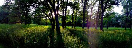
Woods along the Old School TrailBefore I will get to the link to the new DPRT photo pages I wanted to mention that I rearranged all of the photo pages by newest to oldest rides since the old photo pages are from a long time ago and the photo quality is not nearly as good as the newer ones.

Also I wanted to mention that with all these high quality photos the one that I selected for this blog is a photo that I took with my iPhone and that also caught some sun glare through the trees. The reason that I selected this one is because I liked the panoramic view (which is real easy to do with my phone) and I liked the way the sun shined through the trees on this part of the Old School Trail.

Once again, the DPRT is a great trail and the intersecting trails ~ the Old School Trail and Captain Daniel Wright Woods Trail in this case ~ are also very nice too.

I have posted our photos and described this ride on the Old School and DPRT Trail Pages that start HERE.

Des Plaines River Trail Ride and Conditions

I rode a 16 mile stretch of the Des Plaines River Trail (DPRT) in Lake County last Sunday and just wanted to post an update on the trail and on my ride.

Des Plaines River Trail

DPRT south of the Old School Forest Preserve

I started my ride near Half Day (I parked at the parking lot by the Egg Harbor Restaurant off of Route 22, Half Day Road) and rode north through Vernon Hills and Libertyville, through Independence Grove, under Interstate 94 and to Washington Street in Gurnee (near Six Flags Great America) where I turned around and headed back to Half Day.

My ride was 32 miles both ways. I like doing the 32 mile ride since that is the distance that I used to ride with my family on the Fox River and Prairie Trails from Dundee to Genoa City Wisconsin (1 way). We did this ride both ways a few times but would sometimes just go one way and have someone (usually me) turn around half way to go back for the car and pickup the other weary riders in Wisconsin.

Anyway back to my DPRT ride, the Trail Conditions were just fine. All of the highway underpasses were open (the river is not that high right now) and the trail was dry and in pretty good condition. There were a few rough patches, as usual, and a few loose gravel patches but nothing that was difficult at all. You can see the GPS map of my ride here on the Garmin Connect site.

I rode the trail on a beautiful summer weekend (on a Sunday) so there were more people out on the trail than usual (like on weekdays or in cooler weather). Still this trail does not get nearly as crowded as many of the other trails in here in northern Illinois and this is a very scenic trail and has some nice shady wooded areas for these sunny, hot summer days.

There must have been some equestrian convention going on or something last weekend since I must have passed at least 6 groups of horseback riders on the trail on this ride.

I forgot my good camera and was actually more just into riding on this ride so I don’t have any current photos 🙁 . The photo above was from this same part of the trail (just south of the Old School Trail and forest preserve) from a few years back. Unfortunately I did not have as good of a camera back then (and I think I’ve improved on my bike trail photos over time too) but the trails really looks the same now as it did back then anyway.

The Des Plaines River Trail is incredibly long!  You can ride this trail from the Wisconsin border down to Maywood, Illinois (I believe). I have ridden the trail (at different times) from the Wisconsin border to Park RIdge, Il. You can get the details of these rides and see plenty of DPRT photos on the Des Plaines River Trail pages on this site.

I really like many parts of this trail but the sections from Half Day to Independence Grove, in Libertyville, are some of my favorite parts. There are also some nice side trails off of the main DPRT like the one that winds through Wright Woods just north of Half Day.

I have a lot of work to do at the house this weekend but I might just play hooky and go out and do another long ride instead. 🙂

Chain O’Lakes Trails Ride Report and Photo Pages

I actually rode two Chain O’Lakes trails with a friend back in June but just completed the ride report and trail photo pages this weekend (hey what can I say, I’ve been out riding a lot 🙂 ). Chain O'Lakes Trail in Grant Woods.

We rode the Chain O’Lakes trail that runs through Grant Woods forest preserve near Fox Lake first then drove up to Chain O’Lakes State Park (a little further northwest of Grant Woods) and rode the trails through the park.

I would liked to have ridden from the first trail to the state park trail but could not find a decent route between the two trails so we did an extra bike packing and drove to the state park trail.

Both of these trails are crushed stone and have some fairly steep hills. The trails were in pretty good shape except for a few ruts and washed out places on the state park trail.

These trails are not very long so you can easily ride one or even both of them, as we did, in a day and still have time left over for side trips or whatever else you would like to do.

We took a little side trip to the northern shore of Long Lake and rode around the residential area there during our first ride in Grant Woods. We also took a side trip through some Neighborhoods near Fox Lake where I used to hang out a lot when I was younger.

I have included the bike trail information, ride report and photos in the ever growing list of bike trail pages on this website now. See the Chain O’Lakes Trails pages for the full story and photos.

Took My Flag for a Ride Today

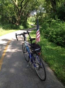
Bike and US flag on bike trail on Independence day.

I pledge allegiance to the bike… and to the United Trails of America!

Just a quick post on my ride today. Well it’s the 4th of July and a beautiful day here in the heartland of the U.S. I had the day off (like so many other people) and decided to do one of my usual rides today (the trail through Paul Douglas woods).

We also had all these small flags stuck in the ground in our neighborhood so I decided to bring one of them with me on my ride (mostly for a photo that I had in mind). So I stuck the flag in a place on the outside of my bike bag and rode off to the trail. I think that I looked pretty festive and patriotic ridin with old glory on my bike today so that was kind of fun.

So that’s my Independence Day ride and story. Today is all about the US and our independence, of course, but I also wanted to mention one other not so US related thing. the Tour de France starts tomorrow! OK, well France did help to support the American revolution so I guess it ‘s related, right? 🙂

Anyway, I’ll be looking forward to the TDF as I usually do and I would encourage anyone that enjoys bike riding to tune in and watch it sometime too. Even if you are not a racer (hey I sure am not one) I think one can find the event entertaining and inspiring.

Happy Independence Day Everyone!

Bike Tire Stats – Continental vs Bontrager

I finally pushed my last set of bike tires to the limit ~ 3,388 miles in this case ~ and ended up with a flat tire last week and a brand new pair of tires this week.

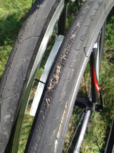
Continental and Specialized  Bike Tires

Old worn out Continental Ultra Sport and New Specialized Armadillo Tires

The tires that I just replaced were Continental Ultra Sport – 700x25c. I wrote a blog post on these and my previous tires, Bontrager Race Light Hard Case – 700x28c, back in September of 2009. See the New Tires Blog Post Enter Here for the detailed stats on my older tires.

Well I keep detailed information on my bike tires and other equipment so now that the Continental tires have reached their limit (or are well past their limit for other riders) I have all of the details on how these tires compared to my previous tires.

Bike Tire Stats:

  • Bought 6/21/2014 Specialized Armadillo 700x25c $90.00
  • Bought 9/27/2011 New Columbia Ultra Sport 700c25c $48.00 Miles used 3,388 2 yrs 9 mos Cost/mile 0.0141677 Cost/1000 miles $14.17
  • Bought 7/1/2008 New Bontrager Race Light Hard Case 700c28c $80.00 Miles used 4,907 3 yrs 2 mo Cost/mile 0.0163032 Cost/1000 miles $16.30
  • Bought 8/10/2005 Original Tires – 8/10/05-7/1/2008 Miles Used: 3,719 2 yrs 3 mos

So there you have the latest stats on the various tires that I have used on my Trek 1500 over the years.

The Flat Tire Story

Well I was just out on a local ride not far from my house when I got my flat tire but I had checked the weather radar before I left and I did not have a lot of extra time before I saw some storms heading towards me.

Fortunately my daughter was home and was able to come out and save me before the storm hit.I slid my Topeak Bike Bag off along with my GPS Bike Computer then locked my bike so I could go back and get my van to pick it up. My friend called it my “SAG Car” like those team cars that follow around the racers in bike races.

I didn’t have a spare tire or a patch kit with me so I didn’t have a lot of options anyway. In this case it worked out well because if I would have taken the time to fix the flat tire instead of calling my “Sag car” to pick me up I would have gotten soaked. We had a major downpour!

I do believe that it was the extremely worn tires that caused this particular flat so I was actually very lucky that I was not 20, 30 or more miles out like I was on some of my recent longer rides. I do plan on carrying a spare or patches (or both) on my next long ride so I don’t get stranded if this happens then.

Speakin of rides… I did do a couple of new rides recently up in the Chain of Lakes area. Actually, I was on the Chain Of Lakes Trail in Grant Woods and the trail in the Chain of Lakes Park. I have photos but have not had a chance to post them and write the story yet. I hope to get to that soon and I will post an update here too.

Hope you all are enjoying this excellent riding weather!

Great River Trail Ride, Wisconsin

I finally had the opportunity to ride the Great River Trail (GRT) in Wisconsin last week and it did turn out to be a pretty “great” ride ~ although it would have been nicer if I had left a little earlier so I did not have to rush so much to try to get back before it got dark.

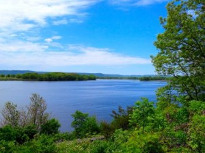
Lake Onalaska from the Great River Trail

Lake Onalaska as seen from the Great River Trail

OK, the “great” in the trail name actually refers to the Great River ~ the Mississippi, of course ~ that flows near or next to the trail in some places. The most scenic part of this trail, in my opinion, is where it runs next to Lake Onalaska which forms the widest part of the Mississippi River.

This trail is 24 miles, one way, and runs from the town of Onalaska (on the southeast end) to the town of Trempealeau and through the Trempealeau Wildlife Refuge (at the northwest end).

I actually started my ride on the Lacrosse River Trail (LRT) in West Salem, Wi. which is about 7 miles east of the GRT. I have wanted to ride all 4 of the bike trails that run from Reedsburg, Wi. to the Trempealeau Wildlife Refuge for a long time now and, with this ride, I have ridden all 4 trails. I have ridden the entire distance of all of these trails now ~ approx. 100 miles at different times ~ with the exception of the Lacrosse River Trail where I only rode the 7 miles on this ride to get to the GRT.

You can get the details, maps and first hand ride photos of all 4 of these west central Wisconsin Trails from our Wisconsin bike trail articles on any one of these trails.

For example, see The Great River Trail home page (here) for the latest updates and photos on this trail and/or maps and descriptions of the other 3 connecting trails that make up this 100 mile route through west central Wisconsin.

A cyclist and friend of mine had ridden, photographed and written about the Great River Trail back in the Fall of 2006. You can find his ride story and photos along with the latest photos and updates from my recent ride via the Great River Trail link above.

Lake Onalaska at sunset

Lake Onalaska near sunset

I enjoyed my ride on the Great River Trail last week although, as I mentioned above, I did not leave quite enough time to ride the distance that I had planned (64 miles both ways) and I had to rush more than I would have liked and ended up riding the last 5 miles or so in the dark (with no bike light, of course)

Fortunately, the trail itself was in great shape (very flat and well groomed) and was straight and flat so it was not as bad as riding a poorly maintained or more difficult trail in the dark.

I have included photos in this blog post of Lake Onalaska from early afternoon and at sunset from the pictures that I took on this ride. It can be a little difficult getting early evening photos of Lake Onalaska from the trail since you are looking west and right into the sun.

For a more detailed update and/or for the full Photo Tour of this ride see the Great River Trail link above or see The Great River Trail Photo Page 3 (here) to go directly to the photos from this May, 2014 ride.

Millennium Trail Connection to North Shore Bike Path

I have ridden most parts of the Millennium Trail (MT) and the North Shore Bike Path (NSBP) in the past but had never ridden the far eastern part of the MT or the far western part of the NSBP and since both parts of these trails run parallel to Route 176 I was curious if the 2 trails connected to each other. Millennium Trail East near Route 176

First, I researched this on Google Maps, which is a great way to check out trail connections or new trails and new bike routes. You can start out with Map View and zoom in to where you are planning your ride then check out the actual terrain with Satellite View or zoom in further for the Street View if it is available. Google does not have all of the smaller trails listed in their mapped areas but they do have most of the longer trails.

Anyway, I found that the 2 trails do NOT connect directly to each other but you can take the MT east to Midlothian Road then ride alongside Hawley Street on the sidewalks (or on the street if you don’t mind riding in traffic) to get to the NSBP at Carmel Catholic HS.

You can get a good idea about the routes on Google Maps but I wanted to see what it was like first hand so I headed out to the Country Bumpkin Nursery ~ at Gilmer Road and 176, which is where I wanted to start my trip east ~ to check it out this trail connection.

My experience on this ride was that the eastern part of the MT was not all that great but it was paved and straight so you could go fairly fast if you like, the trip through Mundelein on the sidewalks pretty much sucked and the western part of the NSBP was actually pretty nice.

I also did a short ride on the Des Plaines River Trail (DPRT) when I got to it from the NSBP. The DPRT is actually one of my favorite trails in the area.

So in addition to this blog post, I wrote up the details on this ride along with photos and the GPS Maps of the rides on the following pages: Millennium Trail Connection to North Shore Bike Path and the NSBP West End Photo Page.

So many trails… so little time…