Moraine Hills Bike Trail ~ Photos and Ride Report

I have been wanting to check out the trails in the Moraine Hills State Park (just south-east of McHenry) for a while now and finally had a chance to ride the trails last Tuesday (7/3). This was during our heat wave and our drought but the ride was still scenic and it is a really nice area for a fairly short ride and photos.

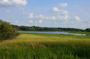
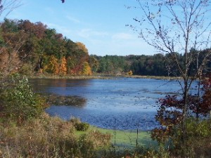
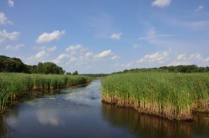
Wetlands and stream into Moraine Hills Park

Wetlands and Stream in Moraine Hills State Park

I had my camera and GPS Bike Computer with me so I could post photos and document the ride of course and I have posted quite a few photos, along with the bike trail article on this trail here at the Moraine Hills Bike Trail Photos and Ride Report.

As I was updating my photos and the article on this bike trail I searched for other photos of this park and trail and found that it looks quite different at different times of the year. My photos are from a drought in the middle of summer but the scenery looks quite different in the spring, fall and winter. I hope to make a few more trips out there in the different seasons to check out the contrast. When I do, I’ll try to add some updates to the new Moraine Hills Trail pages.

Where I parked, at Pike Marsh (on the south-eastern part of the park), you can get on the main Moraine Hills Trail and the River Road Trail which runs mostly parallel to the MHT at that point . I accidentally got on the River Road Trail and took a 3 mile detour when I first started. This was still the same are and it was also a pretty nice ride but it was not on the actual Moraine Hills Trails.

When I got back on the main trail again I headed south-west first to the Fox River and the McHenry Dam and then around the Black Tern Marsh. This area looked nice but I stopped at one point, close to the marsh and got attacked by some kind of flies. I had to get

Lake Defiance in the Distance

Lake Defiance in the Distance

moving again to ditch them. Later I stopped by the Black Tern Viewing Platform, which was very nice (and no flies) and took some photos.

After that, I headed north again (to the other side of River Road) and rode both loops on the northern part of the park. The loop on the west side goes into what they call the Northern Woods and goes around the Leatherleaf Bog Nature Preserve and the loop on the east side goes around Lake Defiance.

I picked up a map of the park and trails at the park entrance which I have scanned and posted on the Moraine Hills Trail article (the link above) along with the GPS map of my ride (including the River Road detour).

As for the trail itself, it is a combination of crushed stone and paved surfaces (mostly crushed stone) and was in very good condition. There is also a combination of hills and flat lands. Most of it is fairly flat with a few steep hills mostly in the northern section (you can actually see the hills and elevations on the GPS map of my ride that I posted with the article linked to above (using the “Player”option on the Garmin page).

Well, that’s about it for this ride (until I check it out in another season). If you are looking for a fairly short, leisurely ride in a nice park with some nice scenery to enjoy or photograph then you may want to check out the Moraine Hills State Park Trails.

Evanston Lakefront Bike Paths ~ Wilmette to Chicago

I was finally able to get out to the Evanston Lakefront Bikeways earlier this week for a ride, photos and ride report. It was a little windy but still a beautiful day on Monday when I rode the Evanston Bike Paths.

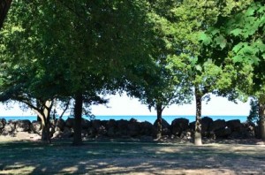
Evanston Lakefront Bike Path

Lake Michigan as seen from the Evanston Lakefront Bike Path.

I often refer to this route as “bikeways” since this is not really a specific bike path but a series of bike paths, a bike lane on Sheridan Road, roads through Northwestern University and even sidewalks that you need to ride on to get through all of Evanston along Lake Michigan.

I started my ride in Wilmette ~ around Gillson Park ~ rode down Sheridan Road to Northwestern University ~ where you can get on a bike path right next to Lake Michigan ~ through Evanston and even into Chicago where I turned around at Rogers Avenue Beach.

Most of this ride is very nice although it is not a bike path the entire way and you need to hop on to roads and sidewalks to get through Evanston. I think that the best part of this bike route is the bike path that starts at Northwestern University and goes south to Lee street. This part is almost all paved and right next to Lake Michigan although is is only a 2 mile stretch.

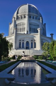
Bahai temple in Wilmette

The Baha'i temple in Wilmette

Another nice thing about this bike route is that you can connect to the Green Bay Trail at the north end or to the Chicago Lakefront Bike Path on the south (although you need to ride about a mile and a half in the city to get to it).

I brought my camera and GPS bike computer to document the ride and post it here, of course so you can read all about this bike path ~ and see the photos ~ at the new Evanston Lakefront Bikeways page.

I really enjoyed this ride and I always love being out by Lake Michigan (especially on really hot days) but one of my favorite parts of this ride was my side trip to the Baha’i temple in Wilmette for photos and my ride to the beach at Gillson Park (also in Wilmette). The Baha’i temple is a beautiful building and I actually spent a lot of time at the beach at Gillson Park when I was younger and I still like it there.

Since I had my camera with me for the bike ride photos, I took advantage of the photo op at the Bahai temple and I also posted quite a few photos of this landmark building on the last photo page for this ride. This is probably one of my favorite bike trail photo pages now even though most of it is not actually on a bike trail. You can see these photos here at the Evanston Lakefront Bike Path Photo Page 4.

I have been aware of the Bahai temple and knew where it was for many years but I never actually went over to it for a closer visit. I was glad that I did on this trip. The building, architecture, and exterior decorations are beautiful and made for some good photos.

Although I had heard of the Bahai faith ~ mostly because of some songs on a Seals and Crofts album (they wrote and recorded the song “Summer Breeze” and were Bahai followers) ~ I ended up looking up a bunch of information on the religion and on the temple in Wilmette on the internet when I got back and was posting the photos and bike ride article.

I thought that it was really interesting that some of the columns on the temple were decorated with swastikas along with the star of David and the Christian cross.  After looking this up on the internet I found that the swastika has been around for centuries and has been used as a symbol good things for various religions and civilizations long before it was used as a symbol for hatred and racism by the Nazis.

Well that’s it for the Evanston Lakefront bike ride. This is prime-time bike riding season so I’ll be selecting, riding and reporting on another trail soon and hope that you cyclists out there are also able to get out and enjoy some good riding!

Des Plaines River Trail ~ Lincolnshire to Dundee Ave in Wheeling

I have wanted to check out the gap in the Des Plaines River Trail (DPRT) just south of Lincolnshire for quite some time now and made it a priority since some visitors to this site had organized a 61 mile ride in the surrounding area and were planning on using this part of the trail for the ride and I offered to see if you could get through or not.

I discovered that, although there is a 1/4 mile gap in the trail it is shorter than it used to be and much easier to get around than it was a few years back when I had ridden on this part of the trail.

DPRT South of Lincolnshire

Des Plaines River Trail around Lincolnshire

It was also a beautiful day for a ride on Friday and I did a nice, scenic 12 mile ride on this part of the trail which included sections that I had never been on before.

I brought my camera and bike GPS (of course) since I needed to document the gap in the trail and I had planned to ride another trail in Evanston later in the day.

After I discovered that I could get through the 1/4 mile gap I just decided to ride further south on the DPRT and photograph and document this part of the trail for this website since I had previously only ridden and written about the northern parts of this trail ~ from Lincolnshire north to the Wisconsin border.

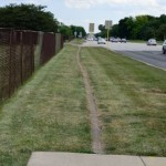
Dirt Bike Path next to Milwaukee Ave.

Dirt Bike Path next to Milwaukee Ave.

The Gap in the Des Plaines River Trail

As for the gap in the trail, it is around Lincolnshire just south of the 28 Mile marker on the trail (as you head south) and the signs direct you out to Milwaukee Avenue. Milwaukee Ave. is a busy and major road but there is a sidewalk on one side and a dirt path, next to the road, on the other side (see the photo).

This is only a very short distance (right around the Par-King miniature golf course and north of the Cubby Bear restaurant) so it is not a big deal if you need to connect from the northern part of the DPRT to the southern part.

You get back on to the Des Plains River Trail at the back of the Cubby Bear parking lot.

The Photos and Ride Report

As I mentioned, I had already ridden, photographed and posted an article and photos of the Des Plaines River Trail from Lincolnshire north all the way to just before the Wisconsin border here. Unfortunately, these rides were from 2004 and 2005 and the quality of the photos are not nearly as good as the newer photos (I am just going to have to ride that part of the trail again and upgrade the photos I guess!)

The photos and ride report that I just did on Friday include  The Des Plaines River Trail Photo Page 8, Photo Page 9, Photo Page 10, and Photo Page 11. My bike trail photo pages use kind of an old style photo display format but it is consistent and fairly easy to navigate with the links at the bottom and at the top of the pages. There is also a link to the GPS map at the bottom of these pages if you want to see exactly where this ride was.

DPRT Trail Conditions

As for the conditions of the trail in this section there were no problems at all (other than having to go along Milwaukee Ave for the 1/4 mile to get around the gap in the trail). Keep in mind that most of the DPRT is a crushed stone trail so if you prefer a paved path you’ll need to find another. The surfaces in this section were in pretty good shape.

The underpasses in the DPRT have signs well ahead of time letting you know if they are open or not. Since the underpasses go along the river and under the roads, I have seen them flood occasionally when the river is high. That is no problem at all right now with it being as dry as it has been recently. The only underpass on this particular section of the trail was at Deerfield Road.

Next Trail Rides

I still plan on riding some of the trails that I just discovered in Evanston next but one of my missions after that is to ride further south on the Des Plains River Trail. I kind of wished that I went further south on Friday but Dundee Road seems to be a natural (or actually not so natural) barrier and it looked impossible to cross during rush hour (when I was there). There may be a way to get to the intersection and cross there but I did not check into that.

I understand that the DPRT goes quite a bit further south from here and that some sections are very nice and scenic. If you are really ambitious (and get up early enough) you could ride the entire Des Plains River Trail from the city of Des Plaines (or possibly even further south ~ like I said I have not been on that part of the trail) all the way north to just before the Wisconsin border (and back?) now that would be quite a ride!


Millennium Trail ~ Ride Report and Photos

Last week I added the Millennium Trail to the list of bike trails that I’ve ridden in the Chicagoland area. I brought my camera with me, of course, so I could photograph the trail and post the ride report and photos of this trail on this website.

The Millennium Bike Trail

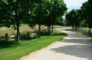
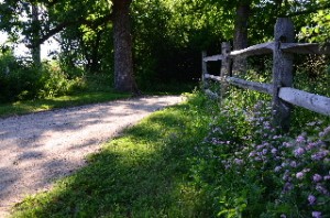
A scenic and wooded part of the Millennium Trail

I actually ended up riding this trail 2 times due to a camera problem. On my first ride I discovered that my lens filter (that I use to protect the camera lens) was broken. I have no idea how that happened but I did not want to ride this crushed stone trail without a lens filter so I just left the camera in my car.

For my first ride I parked in a subdivision near the south-east end of the trail just west of Mundelein. There is actually a section of the trail that extends into Mundelein but it just runs right along Route 176, Hawley Street and is straight and not very scenic so I skipped that part of the trail (although it is clearly visible from the road). I rode just over 12 miles (both ways) on my first ride and I got a good feel for the trail.

For my second ride ~ when I took the photos ~ I parked at the Lakewood Forest Preserve parking lot off of Fairfield Road ~ which is right on the trail and has easy access ~ and rode to the south-east end of the trail (where I started the day before) then headed north and west and rode the entire trail.

The Millennium Trail is actually a really nice trail in Lake County. It’s very  hilly in some parts and almost all crushed stone (except for the far northern section and the part that goes into Mundelein). There are some places where the crushed stone is a little thick and loose so you need to be aware of these parts if you have a road bike (like I do) or if you are going fairly fast.

I had my Garmin Edge 800 GPS bike computer with me too (of course) so I was able to upload and post a link to the map for this trail also.  One note on the trail map that I posted is that I accidentally pressed the wrong button on the northern end of the trail (I meant to hit the lap button but hit the start/stop button) and, after I discovered my mistake (just south of Singing Hills Forest Preserve), and turned it back on it added a straight line to the top of the map after I posted it online (sorry about that).

If you are interested in riding this trail and would like to see the map and some photos of the trail to see what it is like, I have posted my report, map and photos of the trail here at the Millennium Trail Photos and Ride Report.


Skokie Valley Bike Path Ride

This past Sunday I selected a bike trail  in our area ~ from my master bike trail map ~ that I had not yet ridden. Although I have ridden bike trails that connect to this bike path and very close to it, I had never ridden the Skokie Valley Bike Path (until now).

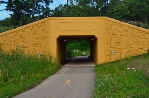
Yellow Tunnel on Skokie Valley Bike Path

The yellowish tunnel on the Skokie Valley Bike Path

This bike trail is in a nice area (Lake Bluff, Lake Forest, Highland Park) but it is really not a scenic trail at all. It runs under a row of power lines, along a major highway (Skokie Highway, Route 41) and through some industrial and commercial areas. I had my camera and my bike GPS computer with me so I have written a trail page article on it and have photographed the trail and posted the pictures.

You can find the Skokie Valley Bike Path Article here.

Keep in mind that, although this bike path runs along the Skokie Hwy it does not go to or through the city of Skokie.

Although this bike path is not very scenic it does still have some good features.  First of all it provides a good connection between the North Shore Bike Trail near Lake Bluff to Highland Park and to the Botanic Gardens, a little past the southern end of the Skokie Valley trail.

Since this bike trail is paved, straight, mostly flat and does not have many intersections that you need to cross, it is also good for speed and a good workout.

I ran out of time on my ride but I wish that I would have had the opportunity to ride through the Botanic Gardens after I reached the southern end of the SV Bike Path (at Lake Cook Road in Highland Park). You can also connect to the North Branch Trail(s) from the Botanic Gardens and continue south from there if you like.

Well this is the time of year to get out and explore new bike paths and I already have my next one selected for later this afternoon. So stay tuned (stop back soon), I will be posting more bike trail ride reports and photos soon!

Cycling Events and Bike Trail Articles Delay – Leg Injury

This is the time of year when I am usually out blazing new bike trails and taking photos (and even videos sometimes) but if you are wondering why I haven’t been posting new trail pages and photos recently it is because I am currently on the Disabled List. 🙁

I have had leg injury that I have had for months now but seemed to be in remission. Well, it acted up again and I have been unable to ride (and even having a hard time walking) for the last few weeks now (since just after Easter weekend). It is driving me crazy to be missing out on all this good riding weather! Actually April has been a little chilly (March was better this year) but it is still quite acceptable riding weather.

Anyway, as for the injury, I am off to the chiropractor this afternoon. I am hoping that he can perform some of his voodoo and speed up the recovery time a little.

Door County Dentury Ride

Door County Century Ride

The other thing that I wanted to mention today is that I just updated my Cycling Events Calendar Page with a new ride that I just heard about from a contact that I have at Livestrong who I just discovered is also a pretty major cyclist.

The ride that I just heard about is the Door County Century Ride which takes place this year on 9/9/12. Although, I am not really into a lot of organized rides myself, this one sounds very interesting to me. I like that there is no formal start time (they suggest between 6:30am and 10am) and you can do the full Century or they have routes for 28.5, 50 and 70 mile rides. The ride is not until September but registration is open and there is a link to the website on the Cycling Events Calendar page.

I have also rearranged the Cycling Events Calendar page so that the events that are coming up first are at the top of the page. Initially I did not have many events or rides out on this page so it really didn’t matter but as I add more this makes a lot more sense.

As I was rearranging this page I noticed that the Bike The Drive event is coming up next. This is the ride where they close down Lake Shore Drive in Chicago to cars and trucks and open it up for cyclist for a few hours in the morning. So if you are considering doing this ride this year it is coming up soon!

I have always wanted to do this ride myself but it is always so early in the morning (yawn) that that kind of discouraged me. Maybe this year… Just maybe ~ well, I have to get my leg back first anyway.

Green Bay Bike Trail Ride and Photos

This past Sunday (Easter Sunday) I was in Winnetka and had an opportunity to ride the Green Bay Trail and get some new photos. I have ridden the entire Green Bay Trail ~ and even the connecting Robert McClory Trail ~ in the past and the GBT is a really beautiful and scenic bike route so I did not want to pass up the opportunity to ride this trail again.

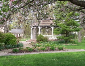
The Gazebo at the Henry J Kalk Park along the Green Bay Trail

The Gazebo at the Henry J Kalk Park along the GBT in Glencoe

I also had a batch of photos of the southern end of the Green Bay Trail (from Glencoe south to Wilmette) that I had lost (!) so I did not have photos of the southern part of the bike trail posted ~ until yesterday that is!

It was a beautiful day on Sunday (a little chilly but still nice) and on the first part of my ride I felt like I was in the Easter Parade! 🙂 There were a lot of people out on the trail ~ riding, walking, jogging ~ in the mid-afternoon.

I started my ride in Winnetka but headed south to the southern end of the trail ~ in Wilmette ~ so I could ride the entire trail. I stopped a lot on my way north for photos (for this site). It is always great to have the photos but it is not nearly as nice, as far as the bike ride goes, to stop all the time for the photos (although I do like taking the photos too).

I rode the entire GBT ~ through Wilmette, Kenilworth, Winnetka, Glencoe, and Highland Park ~ and a little bit of the southern part of the Robert McClory Trail up to Highwood. I stopped at Central Park, in Highland Park ~ on Lake Michigan ~ for a short break and a beautiful view of the lake. Then for the ride back, I just rode (no photos) and it was a really nice ride.

I have had the Green Bay Trail page and photos on this bike site since 2005 but, as I mentioned above, I was missing the southern section (south of Glencoe). Yesterday, I did some updates to the original Green Bay Trail page Here , have added a few photos to the original batch and have added 3 new photo pages of the GBT starting with Green Bay Trail Photo Page 7 (including page 8 and 9).

Back in 2007 I had one of the GBT photos featured in an article in the North Shore Magazine (that photo is on the top of Photo Page 5). I actually think that this round of photos is much better so I maybe if I get lucky I can get another one published in hard-copy form. 🙂

Anyway, the GBT is still a really nice bike trail and an excellent ride. There are also some nice places to head a few blocks east out to Lake Michigan for some excellent scenery. At the time of my ride there was no construction or detours on the trail so it is wide open this year.

For those of you who live in the Chicagoland area (or will be visiting here) I hope you can get out to the GBT at some point.

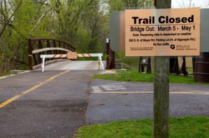
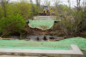
Bridge Out McHenry Co. Prairie Trail North of Fox River and FRT

I was just informed a few days ago that there is a bridge out on the McHenry County Prairie Trail just north of where you cross the Fox River and Route 31 in Algonquin. This is kind of a bummer for those of us who like to ride the northern part of the Fox River Trail then connect to the Prairie Trail and continue north.

Bridge Out Sign on Prairie Trail

Bridge Out Sign on Prairie Trail with Expected Completion Date

It doesn’t look like it would be easy (or maybe not even possible) to cross the tributary where the bridge is out. I was looking at this area on Google Maps and it looks like there could be a way around this but it might be tricky for those of us who are not real familiar with the area and the local roads.

The bridge is supposed to be back around May 1st but there is a lot of good riding time between now and then so I may actually head up there to check this out and see if there is a way around the missing bridge (like the famous Led Zeppelin line “has anyone seen the bridge?!?”)

Anyway, if anyone out there already knows a way around this please post a reply or send me an email.

The photos on this blog post are compliments of Dale Kiffel.

Bridge Out on Prairie Trail

Bridge Out on Prairie Trail

About-Bicycles Page and Blog Posts on Facebook

About-Bicycles.com is Goin Social!

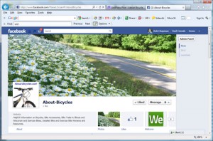
Yep, I finally launched the About-Bicycles.com business page on Facebook so for the many of you that have subscribed to this blog you now have another way to get our updates and read these blog posts.

The About-Bicycles Facebook Page.

The About-Bicycles Facebook Page.

Here’s a link to the new About-Bicycles Facebook page. This page is new so we really don’t have much content out there just yet, but there will be soon.

Also, if I did the setup correctly, these blog posts should automatically be posted to the About-Bicycles Facebook page so if you choose to Follow About-Bicycles on Facebook, you can get our blog posts right there in Facebook instead of visiting us here on our website ~ of course, you are always welcome to come out here as often as you like too :-).

I have also setup this blog to be tweeted via our Twitter account About_Bicycles.

So come on out to the  About-Bicycles Facebook page and “Like” us and Follow Us! Let’s get social!

400 State Trail Wisconsin, October Ride

Riding season is not over yet!

As a matter of fact, this is actually a really nice time of year, here in the Chicagoland area (and in Wisconsin), for bike riding.

A friend and I have just returned from an excellent bike ride that we did on the 400 State Trail in Wisconsin. It is pretty much peak season for fall color in this part of Wisconsin so if, by some chance, you are able to plan a ride in the south-western part of Wisconsin (not far from the Dells) I would highly recommend the 400 State Trail.

Both of us took quite a few photos while we were out on the 400 Trail and, as usual, I have uploaded all of our photos, selected and formatted the best and most relavant bike trail photos and have posted a full Bike Trail Article (with photo pages) on this site for this trail.

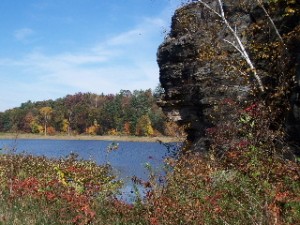
The new Bike Trail information  and photos can be found on our New 400 State Trail Pages. A view of a rock formation and lake along the 400 State Trail

I have actually been wanting to ride this trail for years now since I had already ridden (and photographed) the Elroy-Sparta Trail and my friend has contributed bike trail articles and photos of the other 2 bike trails, the Lacrosse River Trail and the Great River Trail that make up this series of connecting bike trails (referred to as Bike 4 Trails, in Wisconsin).

The 4 connecting trails go from Reedsburg, Wisconsin (on the south east end) to the Mississippi River (around Lacrosse, Wis) and north along the Mississippi to just past Trempealeu Wisconsin for a total of 101 miles (one way)!

For our trip, we just did an easy ride on the 400 State Trail from Reedsburg to Elroy and back for a total of 44 miles. Although we just did the 400 Trail on this trip, I now have complete trail pages and photos for all 4 of these bike trails on this site. If you check out the new 400 State Trail Article, there are links to the 3 other connecting trails on the main trail page.

It has actually taken me WAY longer than I thought it would to select and format all of the photos (I selected 49) and web pages for the trail article. I have been using almost the same format for my bike trail pages as I used when I first started this bike site and it is very time consuming.

Plenty of fall color on the 400 State Trail in Wisconsin

The good side to using the same format is that all of the trail articles and photo pages are consistent. The bad side is that it is cumbersome to use this format and there are probably newer and nicer formats out there. Well, at some point I will transition to a new format but for now, I hope you still enjoy the trail and photo formats that we’ve been using for years now.

So don’t give up on riding season yet! There is still some good weather and excellent rides to be taken!