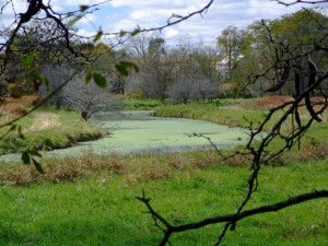
Millennium Trail ~ Ride Report and Photos

Last week I added the Millennium Trail to the list of bike trails that I’ve ridden in the Chicagoland area. I brought my camera with me, of course, so I could photograph the trail and post the ride report and photos of this trail on this website.

The Millennium Bike Trail

A scenic and wooded part of the Millennium Trail

I actually ended up riding this trail 2 times due to a camera problem. On my first ride I discovered that my lens filter (that I use to protect the camera lens) was broken. I have no idea how that happened but I did not want to ride this crushed stone trail without a lens filter so I just left the camera in my car.

For my first ride I parked in a subdivision near the south-east end of the trail just west of Mundelein. There is actually a section of the trail that extends into Mundelein but it just runs right along Route 176, Hawley Street and is straight and not very scenic so I skipped that part of the trail (although it is clearly visible from the road). I rode just over 12 miles (both ways) on my first ride and I got a good feel for the trail.

For my second ride ~ when I took the photos ~ I parked at the Lakewood Forest Preserve parking lot off of Fairfield Road ~ which is right on the trail and has easy access ~ and rode to the south-east end of the trail (where I started the day before) then headed north and west and rode the entire trail.

The Millennium Trail is actually a really nice trail in Lake County. It’s very  hilly in some parts and almost all crushed stone (except for the far northern section and the part that goes into Mundelein). There are some places where the crushed stone is a little thick and loose so you need to be aware of these parts if you have a road bike (like I do) or if you are going fairly fast.

I had my Garmin Edge 800 GPS bike computer with me too (of course) so I was able to upload and post a link to the map for this trail also.  One note on the trail map that I posted is that I accidentally pressed the wrong button on the northern end of the trail (I meant to hit the lap button but hit the start/stop button) and, after I discovered my mistake (just south of Singing Hills Forest Preserve), and turned it back on it added a straight line to the top of the map after I posted it online (sorry about that).

If you are interested in riding this trail and would like to see the map and some photos of the trail to see what it is like, I have posted my report, map and photos of the trail here at the Millennium Trail Photos and Ride Report.

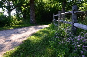
 

Skokie Valley Bike Path Ride

This past Sunday I selected a bike trail  in our area ~ from my master bike trail map ~ that I had not yet ridden. Although I have ridden bike trails that connect to this bike path and very close to it, I had never ridden the Skokie Valley Bike Path (until now).

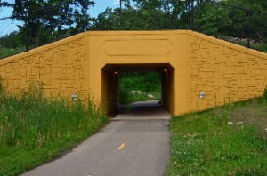
Yellow Tunnel on Skokie Valley Bike Path

The yellowish tunnel on the Skokie Valley Bike Path

This bike trail is in a nice area (Lake Bluff, Lake Forest, Highland Park) but it is really not a scenic trail at all. It runs under a row of power lines, along a major highway (Skokie Highway, Route 41) and through some industrial and commercial areas. I had my camera and my bike GPS computer with me so I have written a trail page article on it and have photographed the trail and posted the pictures.

You can find the Skokie Valley Bike Path Article here.

Keep in mind that, although this bike path runs along the Skokie Hwy it does not go to or through the city of Skokie.

Although this bike path is not very scenic it does still have some good features.  First of all it provides a good connection between the North Shore Bike Trail near Lake Bluff to Highland Park and to the Botanic Gardens, a little past the southern end of the Skokie Valley trail.

Since this bike trail is paved, straight, mostly flat and does not have many intersections that you need to cross, it is also good for speed and a good workout.

I ran out of time on my ride but I wish that I would have had the opportunity to ride through the Botanic Gardens after I reached the southern end of the SV Bike Path (at Lake Cook Road in Highland Park). You can also connect to the North Branch Trail(s) from the Botanic Gardens and continue south from there if you like.

Well this is the time of year to get out and explore new bike paths and I already have my next one selected for later this afternoon. So stay tuned (stop back soon), I will be posting more bike trail ride reports and photos soon!

Green Bay Bike Trail Ride and Photos

This past Sunday (Easter Sunday) I was in Winnetka and had an opportunity to ride the Green Bay Trail and get some new photos. I have ridden the entire Green Bay Trail ~ and even the connecting Robert McClory Trail ~ in the past and the GBT is a really beautiful and scenic bike route so I did not want to pass up the opportunity to ride this trail again.

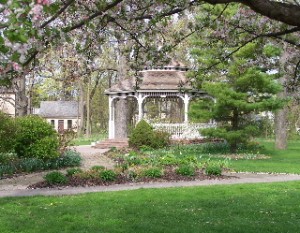
The Gazebo at the Henry J Kalk Park along the Green Bay Trail

The Gazebo at the Henry J Kalk Park along the GBT in Glencoe

I also had a batch of photos of the southern end of the Green Bay Trail (from Glencoe south to Wilmette) that I had lost (!) so I did not have photos of the southern part of the bike trail posted ~ until yesterday that is!

It was a beautiful day on Sunday (a little chilly but still nice) and on the first part of my ride I felt like I was in the Easter Parade! 🙂 There were a lot of people out on the trail ~ riding, walking, jogging ~ in the mid-afternoon.

I started my ride in Winnetka but headed south to the southern end of the trail ~ in Wilmette ~ so I could ride the entire trail. I stopped a lot on my way north for photos (for this site). It is always great to have the photos but it is not nearly as nice, as far as the bike ride goes, to stop all the time for the photos (although I do like taking the photos too).

I rode the entire GBT ~ through Wilmette, Kenilworth, Winnetka, Glencoe, and Highland Park ~ and a little bit of the southern part of the Robert McClory Trail up to Highwood. I stopped at Central Park, in Highland Park ~ on Lake Michigan ~ for a short break and a beautiful view of the lake. Then for the ride back, I just rode (no photos) and it was a really nice ride.

I have had the Green Bay Trail page and photos on this bike site since 2005 but, as I mentioned above, I was missing the southern section (south of Glencoe). Yesterday, I did some updates to the original Green Bay Trail page Here , have added a few photos to the original batch and have added 3 new photo pages of the GBT starting with Green Bay Trail Photo Page 7 (including page 8 and 9).

Back in 2007 I had one of the GBT photos featured in an article in the North Shore Magazine (that photo is on the top of Photo Page 5). I actually think that this round of photos is much better so I maybe if I get lucky I can get another one published in hard-copy form. 🙂

Anyway, the GBT is still a really nice bike trail and an excellent ride. There are also some nice places to head a few blocks east out to Lake Michigan for some excellent scenery. At the time of my ride there was no construction or detours on the trail so it is wide open this year.

For those of you who live in the Chicagoland area (or will be visiting here) I hope you can get out to the GBT at some point.

Bridge Out McHenry Co. Prairie Trail North of Fox River and FRT

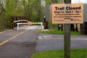
I was just informed a few days ago that there is a bridge out on the McHenry County Prairie Trail just north of where you cross the Fox River and Route 31 in Algonquin. This is kind of a bummer for those of us who like to ride the northern part of the Fox River Trail then connect to the Prairie Trail and continue north.

Bridge Out Sign on Prairie Trail

Bridge Out Sign on Prairie Trail with Expected Completion Date

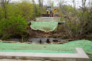
It doesn’t look like it would be easy (or maybe not even possible) to cross the tributary where the bridge is out. I was looking at this area on Google Maps and it looks like there could be a way around this but it might be tricky for those of us who are not real familiar with the area and the local roads.

The bridge is supposed to be back around May 1st but there is a lot of good riding time between now and then so I may actually head up there to check this out and see if there is a way around the missing bridge (like the famous Led Zeppelin line “has anyone seen the bridge?!?”)

Anyway, if anyone out there already knows a way around this please post a reply or send me an email.

The photos on this blog post are compliments of Dale Kiffel.

Bridge Out on Prairie Trail

Bridge Out on Prairie Trail

About-Bicycles Page and Blog Posts on Facebook

About-Bicycles.com is Goin Social!

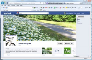
Yep, I finally launched the About-Bicycles.com business page on Facebook so for the many of you that have subscribed to this blog you now have another way to get our updates and read these blog posts.

The About-Bicycles Facebook Page.

The About-Bicycles Facebook Page.

Here’s a link to the new About-Bicycles Facebook page. This page is new so we really don’t have much content out there just yet, but there will be soon.

Also, if I did the setup correctly, these blog posts should automatically be posted to the About-Bicycles Facebook page so if you choose to Follow About-Bicycles on Facebook, you can get our blog posts right there in Facebook instead of visiting us here on our website ~ of course, you are always welcome to come out here as often as you like too :-).

I have also setup this blog to be tweeted via our Twitter account About_Bicycles.

So come on out to the  About-Bicycles Facebook page and “Like” us and Follow Us! Let’s get social!

400 State Trail Wisconsin, October Ride

Riding season is not over yet!

As a matter of fact, this is actually a really nice time of year, here in the Chicagoland area (and in Wisconsin), for bike riding.

A friend and I have just returned from an excellent bike ride that we did on the 400 State Trail in Wisconsin. It is pretty much peak season for fall color in this part of Wisconsin so if, by some chance, you are able to plan a ride in the south-western part of Wisconsin (not far from the Dells) I would highly recommend the 400 State Trail.

Both of us took quite a few photos while we were out on the 400 Trail and, as usual, I have uploaded all of our photos, selected and formatted the best and most relavant bike trail photos and have posted a full Bike Trail Article (with photo pages) on this site for this trail.

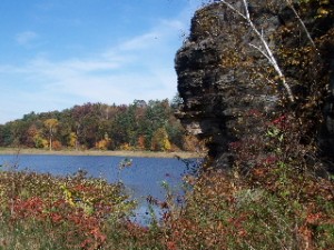
The new Bike Trail information  and photos can be found on our New 400 State Trail Pages. A view of a rock formation and lake along the 400 State Trail

I have actually been wanting to ride this trail for years now since I had already ridden (and photographed) the Elroy-Sparta Trail and my friend has contributed bike trail articles and photos of the other 2 bike trails, the Lacrosse River Trail and the Great River Trail that make up this series of connecting bike trails (referred to as Bike 4 Trails, in Wisconsin).

The 4 connecting trails go from Reedsburg, Wisconsin (on the south east end) to the Mississippi River (around Lacrosse, Wis) and north along the Mississippi to just past Trempealeu Wisconsin for a total of 101 miles (one way)!

For our trip, we just did an easy ride on the 400 State Trail from Reedsburg to Elroy and back for a total of 44 miles. Although we just did the 400 Trail on this trip, I now have complete trail pages and photos for all 4 of these bike trails on this site. If you check out the new 400 State Trail Article, there are links to the 3 other connecting trails on the main trail page.

It has actually taken me WAY longer than I thought it would to select and format all of the photos (I selected 49) and web pages for the trail article. I have been using almost the same format for my bike trail pages as I used when I first started this bike site and it is very time consuming.

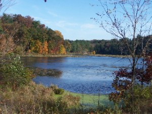
Plenty of fall color on the 400 State Trail in Wisconsin

The good side to using the same format is that all of the trail articles and photo pages are consistent. The bad side is that it is cumbersome to use this format and there are probably newer and nicer formats out there. Well, at some point I will transition to a new format but for now, I hope you still enjoy the trail and photo formats that we’ve been using for years now.

So don’t give up on riding season yet! There is still some good weather and excellent rides to be taken!

River Bend, Randall Road and Great Western Trail Ride

Yesterday, a friend and I went out and explored some new bike trails (which also connected to some bike trails that we had already ridden before) and had a really nice 35 mile ride.

I originally wanted to check out the Randall Road Bike Trail but it is actually a pretty short trail (4 miles) but what we discovered is that this is an excellent way to ride from the Fox River Trail to the Great Western Trail!

The other trail involved in getting from the FRT to the GWT is the River Bend Trail which is also known as the Silver Glen Trail. It is a little confusing since I have seen this trail referred to with 2 different names so I just referred to both names so people can find the info on it using either name.

River Bend / Silver Glen Bike Trail

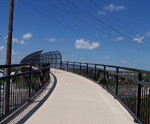
The bridge over Randall Road on the River Bend (Silver Glen) Bike Trail

If you start on the Fox River Trail just before the long bridges in South Elgin, you’ll see a sign for the “Randall & Silver Glen Trails“. This is the River Bend Trail (as it is called on the map in the forest preserve that you go through).   Some of this bike trail goes along Silver Glen Road so I believe that is how the SGT name came about.

Anyway, if you get on the River Bend Trail from the Fox River Trail, you can follow the trail all the way to Randall Road. At Randall Road you can get on the north end of the Randall Road Trail which you can then take south the the Great Western Trail.

We connected to the GWT, as described above, and then took the GWT to Virgil, Illinois where we turned around and went back. I actually put together some bike trail pages, with photos for the River Bend Trail HERE.

The River Bend Trail is nice as you go through the John J Duerr Forest Preserve and if you take it through the wetland area west of Randall Road but the part that goes along Silver Glen Road is not that exciting.

Randall Road Bike Trail

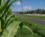
A view of the northern end of the Randall Road Trail from the corn field

The Randall Road Trail is not very exciting either when you first get on at the northern end of the trail (at Silver Glen & Randall) but once you go over the long bridge (that runs parallel to Randall Road), it goes into a nice forest preserve area, followed by a real nice prairie and then you connect to the Great Western Trail (which I have always enjoyed).

There was no construction or detours on any of the trails that I have mentioned above and overall it was a really nice ride.

Fox River Bike Trail Conditions – 2011

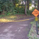
Fox River Trail Closed sign before the tunnel

Well we finally got out to the Fox River Trail this past weekend so I can post an update of the trail conditions from Dundee to Aurora.

There were 2 sections of the trail that were closed. The first section was at the Tunnel/Bridge where the Fox River Trail connects to the Illinois Prairie Path (just  South of Elgin).

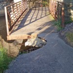
This section has been closed for years now! A large part of the trail has been washed out right at the tunnel and there is a steep drop off from the pavement. I don’t know why they can’t manage to get this repaired!

If you do go around the “trail closed” signs (and I can not recommend that here, of course) you REALLY NEED TO BE CAREFUL AT THE TUNNEL.

Fox River Trail at the Washout

 The other section of the trail that was closed off made absolutely no sense to me at all! This is the section just north of the bridge in South Elgin. We went around the signs and proceeded cautiously. Other than the path being in terrible shape and having a lot of large bumps in the pavement it was just fine.

I think that having these sections closed off causes more problems due to people getting accustom to going around the “trail closed” signs which could have more serious consequences when there is a legitimate need to close the trial

Other than those two sections, the trail was clear with no major problems from Dundee to Aurora (a 55 mile round trip for us).

One really nice improvement (for me since I had not been on the trail this year) is that they finally finished the Stearns Road Bridge project!

They have also built a Bike Repair Station at the part right before the bridge in south Elgin.  This is actually pretty cool but I think that they missed out on one important feature. It is not very obvious that it is there and there is NO SIGN that says that there is a bike repair station there. This can easily be overlooked!

Anyway, at the repair station they have an air pump and tools that are attached to cables. The pump was already a little beat up but it still worked and the tools were all still functional. So if you have a bike problem and can make it to the bridge in South Elgin, you will have some tools available there.

I’ve added a few photos of the new bridge and the bike repair station on the related Fox River Bike Trail Photo Page.

And one final note, which has more to do with our ride than with the Fox River Trail conditions, is that we took a little time to get some photos of the Fabyan Windmill in Geneva, which I had not previously had posted on this site.

Since this is such an obvious landmark along the Fox River Trail, I selected and posted a page with a few of the Fabyan Windmill Photos here.

Paul Douglas and Crabtree Bike Trail Conditions, 2011

Well, we had a pretty nice day for riding here in Chicagoland today and I just got back from riding the entire Paul Douglas Bike Trail and the connecting Crabtree Bike Trail.

I was about to write how there were no problems at all on either of the trails until I got to the very end (last 1/4 mile) of the Crabtree Trail (the northern end). There is one little section that is under construction and the sign says for 2 weeks. It’s really no big deal and it is passable too if you want to get out to the parking area off of Palatine Road.

Anway, as for the Paul Douglas Bike Trail, the entire trail is open and there are no problems. Even the one section that has flooded occasionally (on the west end of Paul Douglas) was clear and dry.

There were some puddles and wet places and my legs got a light spray of water as I rode by (I didn’t slow down much from average of about 13 mph so if you slowed down more you would stay completely dry).

I was glad to see that there was no flooding on the west side of Paul Douglas like there was in the past (see the Paul Douglas Trail flooding page) even though it is still pretty wet out there. Of course we are supposed to get some big storms tomorrow so we’ll see if it stays clear and dry. I am pretty optimistic.

My favorite part of this trail remains the loop around Paul Douglas (skipping the part along Algonquin Road) but the little strip that goes into the Crabtree preserve (about 1 mile) is very nice too. The Paul Douglas loop is about 7 miles (counting the part along Algonquin Road).

Well, it was great to get out there today and the Paul Douglas Trail is still a great place to ride. If anyone has any updates, please let me know or post a reply if you like.

Later, Rob.

Jane Addams and Badger State Bike Trail Ride

The days may be getting shorter but bike riding season is not over yet!

A friend of mine and I went out yesterday to explore some new trails and found the Jane Addams Bike Trail (starting at the southern end near Freeport, Il (west of Rockford) and rode north to the Badger State Trail (which  connects to the Jane Addams Bike Trail at the Wisconsin border) and then on to Monroe Wisconsin! So I guess you could say that we were on the Bike Interstate! 

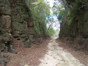
Rock Walls along Jane Addams Bike Trail

It was cool on Saturday but still an excellent day for a ride. I brought my camera and got some photos but I haven’t had a chance to put together an official “trail page”  on this site yet but I hope to do that real soon. I did do a little research on the Internet on both the Jane Addams Trail and on Jane Addams the person and I found that to be very interesting.

As for the bike trail itself and our ride, we did 20 miles each way (40 total) and the trail is a very packed down crushed stone and/or dirt in most places. You can tell that it is a popular place for snowmobiles in the winter.

The trail was out in the country and very scenic. Lots of wooden bridges crossing over wandering streams. This is another rails to trails project and there are many signs that you are riding on a converted railway.  There are also a few passages through some fairly high rock walls as in the photo above.

If you don’t like crowded trails, then this is a great trail for you! We did not see a single other person on the trail for about 8 or 9 miles and then we only saw a few other riders, walkers and joggers total.

As for the trail conditions, the trail was totally dry and clear from the trail head in the south (around Freeport) to Monroe, Wisconsin. There were a few holes in the trail that you needed to watch out for and some of those seed ball like things (the size of baseballs) that I had to dodge a few times, but that was about it as far as obstructions go.

Jane Addams Bike Trail

Scenic View from the Jane Addams Bike Trail (photo by Dale Kiffel)

Well, I’ll try to get a “more proper trail page” with the rest of the photos out here asap but I guess this blog entry will have to do for now.

And on another topic, I contributed a bike trail article for a start up magazine a few weeks ago which earned me the right to meet the Chicago area CBS news person Bill Curtis at his house this weekend! That was really quite interesting and I’ll have more to say on that later, but I’ll save that for the next post.

Stop back soon.