Riding Season and Paul Douglas Flooding

Yep, it is definitely riding season again here in Chicagoland! I’m seeing more cyclists out every day now. Personally, I got a start in February! Yea, that crazy warm weather that we had then but am riding a little more regularly now.

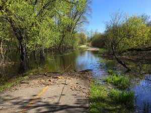
Flooding on Bike Trail

Flooding on Paul Douglas Trail

And of course, with riding season comes flooding season on many trails including the Paul Douglas Trail (PDT) in Hoffman Estates ~ a little southwest of Harper College in Palatine.

Anyone that has ridden this trail fairly often in the spring ~ like myself ~ knows that the western side of the trail, along Hunting-Freeman Road floods pretty regularly.

Well I rode the trail the past two weekends and both weekends it was flooded in this part. BTW, this is the only part of the trail that floods (although there are a few puddles in other areas).

It looks pretty impassable but most of the time you can get through without getting wet ~ except maybe for a few splashes. You can also detour around this pretty safely and easily on Hunting-Freeman Road ~ but what fun is that!

To detour around the flood, go out to Hunting-Freeman at Lakewood Blvd (there is a 2 way stop sign there and a short path to the road there) if you are heading north or at the fire hydrant by the opening on the right if you are heading south. It’s only about 2/10ths of a mile.

Hint for riding through up to 5 inches of water and keeping your feet (and everything else) dry.

I’ve used this method quite a bit and it works well. Last week the flood was about 4 to 5 inches (my best guess) and I stayed completely dry. This past weekend I estimated that the flood was 5 to 6 inches deep and one of my feet did get a little wet so that is about the limit. You must also have a clear path (no obstructions) and it needs to be relatively flat.

You can cover quite a distance this way so here’s what to do: Approach the flooded area fairly slow (just to avoid splashing and sprays) ~ try to keep your pedals parallel to the ground ~ Do NOT pedal all the way around, instead just use short, quick back and forth pedaling strokes keeping your feet above the water.

OK, now that you know the secret, maybe you can go out and find your favorite flooded area and give it a try! 🙂

OK, here’s my CYA Disclaimer: I am not responsible if you get wet or for anything else that happens… It’s just a helpful hint… After all, we are all responsible for our own actions and safety, right? 🙂

Anyway, the PDT is still a good trail to ride in the springtime. This is a completely paved trail that goes around the Paul Douglas forest preserve (I usually skip the part that goes out to Algonquin Road just west of the busy intersection at Roselle and Algonquin Road and east of Ela and Algonquin cause it’s not as nice as the parts that are right up against the forest preserve).

One of the other trails that I know also floods occasionally is the Des Plains River Trail (DPRT) but I usually avoid this one completely in very wet weather since it is not paved and the flooding can be bad in places.

For more on the PDT see the Paul Douglas Trail photo pages HERE on this site. I actually wrote these pages quite a few years ago and they could use an upgrade but there are photos and more information on the trails there.

Well until next time, enjoy the ride(s)!

A Few Des Plaines River Trail Updates

I’ve been out to a couple different parts of the Des Plaines River Trail (DPRT) this summer and have been meaning to post the updates… so here are updates!

My initial goal was to check out the New Extension to the trail between Deerfied Road and the Lincolnshire Marriot where you used to have to go out to a dirt path or the sidewalk along Milwaukee Road between Aptakisic Road and the Cubby Bear sports bar/restaurant. I had heard that this had been completed but had not had a chance to check it out yet. I will get back to that in a moment.

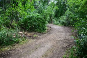
Rugged Bike Trail

DPRT in terrible condition between Northbrook and Wheeling

So my first attempt was to get on the trail at Euclid Ave ~ in Northbrook ~ and head north to Half Day ~ and beyond if I had enough time.

Well, it turned out that the DPRT in this area is in Terrible Condition. Especially the part of the trail from Algauer’s Restaurant to Patawatomi woods in Wheeling.

The trail has a lot of pot holes and loose gravel in places in this stretch. It looks like they had some heavy duty equipment out on the trail removing trees. I guess it is OK for a good mountain bike but it was terrible for my road/path bike.

The entire northern Cook County part of the trail is not in very good condition compared to the Lake County parts of the trail which are mostly really nice.

So back to my ride… with the slow, rugged path, we only made it to Patawatmoi Woods in Wheeling and I was glad to turn back from there.

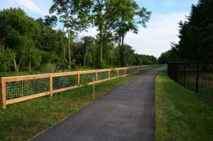
DPRT Trail Extension north of the Cubby Bear

DPRT Trail Extension North of the Cubby Bear

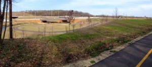
My next DPRT ride, a week later, I started just south of Lake Cook Road heading north and this was a much nicer ride. We made it to and through the New Trail Extention ~ shown in the photo ~ and to Wright Woods, just north of Half Day. This was a Great Ride!

The DPRT trail extension is one of the only parts of the Des Plaines River Trail that is paved. The paved stretch isn’t very long but the crushed stone part of the trail is in great condition in this area too.

The Trail Extension is a very welcome improvement! I would often avoid this part of the trail since I had to go out to busy Milwaukee Avenue for a stretch and then get back on the regular trail again.

It is still a little bit of a pain to have to cross Half Day Road (Route 22) at Route 45 but there are lights there and when there is traffic you just have to wait a little. Then the rest of the trail north of there is really nice.

So before writing this blog post, I updated the Des Plaines River Trail photo pages and ride reports on this site since I had photos and descriptions of how you would have to get around this part of the trail.

I kept the old photos on a separate page (for nostalgia and trail history) and included the new one on the original page.

See the New DPRT Extension North of Cubby Bear page here for the photos and descriptions of this section and The Old Path Along Milwaukee Avenue page here for the historical look at this part of the trail.

So Many Trails… So Little Time…

So far this riding season I have ridden 2 trails, or parts of trails, that I have not ridden in many years ~ Elroy Sparta Trail and Des Plaines River Trail (Far Northern End) ~ and 2 trails that I have never ridden before ~ Prospect Heights Trail and Kankakee River Trail ~ in addition to the trails that I ride all of the time, of course.

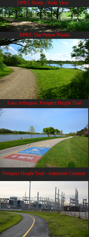
I usually try to post the Ride Report and Photo Tour pages to this site prior to posting a blog about them but it could be quite a while before I get to all those pages so I decided to post a summary of all of these trails first ~ with a few photo collages to go along with the summary.

Stay tuned though because I will post the Full Ride Reports and Photo Tours of these trails eventually.DPRT and Prospect Height Trail

So getting right to the trails.. We rode the Prospect Height Trail first this year ~ in May.

The Prospect Height Trail is in a convenient location (for many of us) but it is a real contract between Nature and Industrial Sprawl.

Most of the time, I just stick to scenic, natural bike trail photos and try to avoid power lines and other distractions unless I am writing about them specifically (which I do on occasion). In this case, the Power Plant along the trail was so obtrusive, I just had to get some close up photos of that. After all, there are trails with all sorts of “scenery”.

This trail connects to the path around Lake Arlington at the northwest end of the trail. Lake Arlington is nice and scenic but in general it is usually really crowded which makes it difficult to ride and not much fun for the short distance involved.

The next section of trail that we rode, and that I have not been to for years was the northern end of the Des Plaines River Trail (DPRT) through Van Patton Woods. I have been on the DPRT many times recently ~ it is one of my favorite trails ~ but I rarely make it all the way to the northern end of the trail ~ near the Wisconsin border.

So for this ride we drove the northern trail head off of Russell Road and went south from there through Van Patton Woods (VPW). VPW is very nice but we were actually there on Memorial Day weekend and it was pretty crowded due the nice day and holiday weekend. We rode south on DPRT to just past Gurnee and back. This is a nice ride.Kankakee and Elroy Sparta Trails

Moving on to June, the next trail that I rode, and haven’t been on for years, was the Elroy Sparta Trail (EST) in Wisconsin.

I rode this trail with my brother who wanted to try a recumbent bike which we rented at a Speeds Bike Shop near the trail in Sparta. The people at this bike shop were really nice and the rental was a pretty good deal.

We didn’t ride far on the EST but I suggested that, as long as we were on this trail, we had to see one of the tunnels. So se started our ride near Norwalk, Wis. and rode to Tunnel #3 (in the photos to the left).

This is the longest tunnel on the trail ~ 3,810 feet to be exact ~ and we walked through the tunnel. If you have never been through one of the converted rails-to-trails tunnels on a bike trail, I would suggest going to one to check it out. It is pretty cool (literally cool too) and interesting.

And finally the last new trail that we rode in June, that I had never ridden before, was the Kankakee River Trail (KRT).

This is a really nice trail and there are quite a few different places along the trail where you can park and get on the trail. We got on the trail at the southeast end just southeast of Willmington, Il off of Route 102.

The Kankakee River Trail is not that long ~ about 11 miles one way ~ but it is a very scenic ride. The trail is mostly paved except for about 3 miles on the northwest end of the trail.

Before we rode this trail I read a few articles that people posted about the trail and they talked about the steep hills on the trail which made me a little nervous. I don’t like really steep hills that are so difficult that you end up walking up the hills.

Well, now that I have ridden this trail, I would say that the hills are not that bad. There are some hills but really nothing all that difficult.

Well, as I mentioned above, stay tuned… because I will eventually post all the photos and ride reports on these trails… and the other trails that I will surely be riding this year also!

BTW, You can click on either of the Photo Collages above for a much larger view of the photos.

BTW2, I keep a lot of stats and things in spreadsheets and I have kept my bike mile totals at the end of each year in one of my spreadsheets. I have been riding over 1,000 miles a year ~ and over 2,000 miles a couple of times ~ and my total miles, since I’ve had Bike Computers (from 1997) is now 20,469.

It just goes to show, if you ride a lot and consistently you do rack up lots of miles…

Old Plank Road Trail Ride

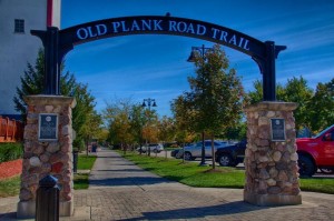
We found a really nice south western Chicagoland bike trail this past fall and I am finally getting around to posting the last of the 2015 riding season photos and ride reports. Old Plank Road Trail Arc h in Frankfort

It is looking like 2016 riding season will be here real soon now (with these 60s in February!) so I’ll be busy riding and collecting new photos and trail information soon.

Anyway, as you can see from this blog post title, we rode the Old Plank Road Trail (OPRT) this past fall (in October). We rode a total of 44 miles on the OPRT and on the trail through the Hickory Creek Preserve but we were just a little early for the new trail extension that they just completed that now connects the OPRT with the Thorn Creek Trail (in case you want to add even more miles to your ride on these trails).

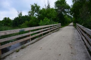
This trail is paved and mostly straight (east and west mostly) and flat although if you want a hilly, curvy ride, the trail that goes through the Hickory Creek Preserve will give you that.

I have ridden many more trails north and west of Chicago and in Wisconsin than I have in the southern Chicagoland area but there are some good trails Down South too! I also like exploring new areas too.

So for a very nice trail south and west of Chicago ~ between Joliet and Chicago Heights ~ check out the Old Plank Road Trail.

For the Maps, including the GPS map of our ride and for the photos and ride report, see our new Old Plank Road Trail pages here.

Stay tuned for the New 2016 Trails and Ride Reports coming soon…

Wisconsin White River Trail and Kenosha Trail Rides

Well I have been putting in some bike miles for this season but have not had a lot of time to update the about-bicycles blog here with all the latest… Until Now!

I am writing this article to let you know about some Southern Wisconsin Bike Trails that I have just discovered or trails that I have ridden in the past and for which I have just now posting the photos and ride reports.

White River Trail Bridge

White River Trail and the bridge over the White River

The first trail that I would like to mention is the White River Trail (WRT)  that heads east and west out of Burlington, Wisconsin. Both sections of this trail go into Burlington but they do not actually connect to each other although you could probably find a way to get from one to the other through the town of Burlington.

You can, however connect to the Seven Waters Trail (SWT) which heads northeast out of Burlington from the East Leg of the WRT. I did not get a chance to ride the SWT but we did ride both sides of the WRT just last month (June 2015).

This was a 38 mile ride and you can find all the details here on the new White River Trail pages. You will find the first-hand ride report, maps and photos of scenes along the trail on these new trail pages.

Kenosha Bike Trail

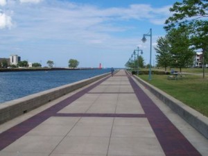
Kenosha Bike Trail on Lake Michigan

Next, I would like to let you know about the new trail pages that I just posted for our ride on the Kenosha Bike Trail (KBT) and Pike Bike Trail (PBT) in Kenosha, Wis.These are some nice bike trails along Lake Michigan just over the Wisconsin border.

We actually rode these trail in July of 2010 and I took a batch of photos but kind of forgot to upload the photos and ride report for this one :-(. So sorry, this ride is from a few years back but it was a very nice ride back then and I’m sure it still is. I would like to ride this one again and continue on to some of the connecting trails.

You can find our ride report and photos for The Kenosha Bike Trails here.

So if you are looking for some nice Wisconsin Bike trails within easy driving distrance from the Chicagoland area, these are a couple of good options.

Like the old cowboy used to say… Happy Trails to You ♫ …

New Prairie Trail Tunnel, Route 31 in Algonquin

I did a short ride on the Fox River and McHenry Co Prairie Trails this past weekend from West Dundee to Crystal Lake and got a chance to see and ride the new trail in Algonquin at Route 31.

New Prairie Trail Tunnel

Prairie Trail Tunnel Under 31

This actually threw me off at first because I was so used to crossing route 31 and riding the trail on the west side of the road. So that is what I did on the way north since this is the way I took when the trail was under construction.

It was a bad way to go and seemed like it was still under construction but when I finally got to the actual trail again I realized that the trail now winds around then goes under Route 31 and alongside the road on the east side now.

It would be nice if they had a sign there to let you know which way to go when you are heading north but now that I’ve done it (and made my mistake on the way north) I will know how to do it next time.

I thought that this change was noteworthy so I took some photos of the new part of the trail and posted them on this site.

You can see the New 2015 Prairie Trail Route 31 Intersection here.

I also updated my Fox River Trail and Prairie Trail pages to include a link to the new intersection. These bike trail pages and photos are from 2003 and I have left the original pages in place since they are almost historical now (or just old…).

Also, who says you can’t travel through time? Well, it might be tricky physically but you can easily travel to the past with PHOTOS!

Since you have to go back and forth between the old and new bike trail pages to compare how this intersection looked in the Past and in the Present (2003 and 2015), I have also included a Prairie Trail Route 31 Past and Present page here.

As for the trail conditions, there was no problem on the Fox River Trail heading north from West Dundee and once you get on the Prairie Trail, the trail is in great shape from Algonquin to Crystal Lake. This section is all new blacktop and provides a nice, smooth ride.

Flooding on the Paul Douglas Trail in the Usual Place

We have had enough nice days here in the Chicagoland area to get out and start accumulating some bike miles now. I only have a little over 100 miles for this season myself and have only been out on my local trails so far this year.

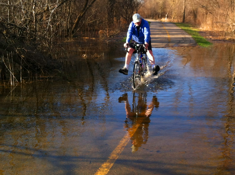
Riding through the flood in Paul Douglas Preserve

Riding the Flood Out

Speaking of local trails, I have ridden the trail through the Paul Douglas Preserve a few times this year and as of yesterday there was some flooding again in the usual place, in the stretch that runs along side of Hunting Freeman Road.

I did not have my DSLR camera with me but my wife and I had our phones, as usual, of course, so I figured I would get some photos of the flood and my wife even got some shots of me riding through the flooded area. It was only about 6 inches deep and I was having a little fun (keeping my feet out of the water in the photo above).

Keeping feet dry pedaling through flooded trail

Keeping my feet dry another way

You could actually ride through the flooded area, without getting your feet wet if you did it the right way, as I did in the next photo. If you do not have a long distance to go through the flood you can keep both pedals mostly parallel to the ground and just do short, partial pedal strokes going back and forth (pedaling a little forward then a little back, then a little forward again, etc…). It works for a short distance and is better than doing full strokes and totally submerging your feet in the water (assuming you want to stay dry). I also noticed that this works best in a little higher gear.

There were a few other wet places on the trail but you could just ride around the water in the other places. Other than that the trail was in pretty good condition.

There were a few places where there was a lot of gravel debris where the trail is close to the roads and the snow was plowed on to the trail and a some small branches and sticks in the trail.

I did my duty and cleared a few larger branches off of the trail where the trail turns at Central and Roselle Roads.

For more information on many of the trails in our area, see our main Bike Trails page. You can also browse this blog using the “Bike Trail Conditions” Category of just use the local search to find the trail that you are interested in.

As usual, enjoy the ride!

Des Plaines River Trail Ride and Conditions

I rode a 16 mile stretch of the Des Plaines River Trail (DPRT) in Lake County last Sunday and just wanted to post an update on the trail and on my ride.

Des Plaines River Trail

DPRT south of the Old School Forest Preserve

I started my ride near Half Day (I parked at the parking lot by the Egg Harbor Restaurant off of Route 22, Half Day Road) and rode north through Vernon Hills and Libertyville, through Independence Grove, under Interstate 94 and to Washington Street in Gurnee (near Six Flags Great America) where I turned around and headed back to Half Day.

My ride was 32 miles both ways. I like doing the 32 mile ride since that is the distance that I used to ride with my family on the Fox River and Prairie Trails from Dundee to Genoa City Wisconsin (1 way). We did this ride both ways a few times but would sometimes just go one way and have someone (usually me) turn around half way to go back for the car and pickup the other weary riders in Wisconsin.

Anyway back to my DPRT ride, the Trail Conditions were just fine. All of the highway underpasses were open (the river is not that high right now) and the trail was dry and in pretty good condition. There were a few rough patches, as usual, and a few loose gravel patches but nothing that was difficult at all. You can see the GPS map of my ride here on the Garmin Connect site.

I rode the trail on a beautiful summer weekend (on a Sunday) so there were more people out on the trail than usual (like on weekdays or in cooler weather). Still this trail does not get nearly as crowded as many of the other trails in here in northern Illinois and this is a very scenic trail and has some nice shady wooded areas for these sunny, hot summer days.

There must have been some equestrian convention going on or something last weekend since I must have passed at least 6 groups of horseback riders on the trail on this ride.

I forgot my good camera and was actually more just into riding on this ride so I don’t have any current photos 🙁 . The photo above was from this same part of the trail (just south of the Old School Trail and forest preserve) from a few years back. Unfortunately I did not have as good of a camera back then (and I think I’ve improved on my bike trail photos over time too) but the trails really looks the same now as it did back then anyway.

The Des Plaines River Trail is incredibly long!  You can ride this trail from the Wisconsin border down to Maywood, Illinois (I believe). I have ridden the trail (at different times) from the Wisconsin border to Park RIdge, Il. You can get the details of these rides and see plenty of DPRT photos on the Des Plaines River Trail pages on this site.

I really like many parts of this trail but the sections from Half Day to Independence Grove, in Libertyville, are some of my favorite parts. There are also some nice side trails off of the main DPRT like the one that winds through Wright Woods just north of Half Day.

I have a lot of work to do at the house this weekend but I might just play hooky and go out and do another long ride instead. 🙂

Chain O’Lakes Trails Ride Report and Photo Pages

I actually rode two Chain O’Lakes trails with a friend back in June but just completed the ride report and trail photo pages this weekend (hey what can I say, I’ve been out riding a lot 🙂 ). Chain O'Lakes Trail in Grant Woods.

We rode the Chain O’Lakes trail that runs through Grant Woods forest preserve near Fox Lake first then drove up to Chain O’Lakes State Park (a little further northwest of Grant Woods) and rode the trails through the park.

I would liked to have ridden from the first trail to the state park trail but could not find a decent route between the two trails so we did an extra bike packing and drove to the state park trail.

Both of these trails are crushed stone and have some fairly steep hills. The trails were in pretty good shape except for a few ruts and washed out places on the state park trail.

These trails are not very long so you can easily ride one or even both of them, as we did, in a day and still have time left over for side trips or whatever else you would like to do.

We took a little side trip to the northern shore of Long Lake and rode around the residential area there during our first ride in Grant Woods. We also took a side trip through some Neighborhoods near Fox Lake where I used to hang out a lot when I was younger.

I have included the bike trail information, ride report and photos in the ever growing list of bike trail pages on this website now. See the Chain O’Lakes Trails pages for the full story and photos.

Great River Trail Ride, Wisconsin

I finally had the opportunity to ride the Great River Trail (GRT) in Wisconsin last week and it did turn out to be a pretty “great” ride ~ although it would have been nicer if I had left a little earlier so I did not have to rush so much to try to get back before it got dark.

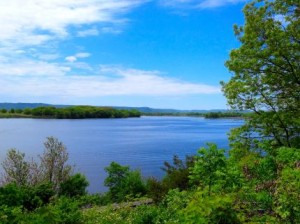
Lake Onalaska from the Great River Trail

Lake Onalaska as seen from the Great River Trail

OK, the “great” in the trail name actually refers to the Great River ~ the Mississippi, of course ~ that flows near or next to the trail in some places. The most scenic part of this trail, in my opinion, is where it runs next to Lake Onalaska which forms the widest part of the Mississippi River.

This trail is 24 miles, one way, and runs from the town of Onalaska (on the southeast end) to the town of Trempealeau and through the Trempealeau Wildlife Refuge (at the northwest end).

I actually started my ride on the Lacrosse River Trail (LRT) in West Salem, Wi. which is about 7 miles east of the GRT. I have wanted to ride all 4 of the bike trails that run from Reedsburg, Wi. to the Trempealeau Wildlife Refuge for a long time now and, with this ride, I have ridden all 4 trails. I have ridden the entire distance of all of these trails now ~ approx. 100 miles at different times ~ with the exception of the Lacrosse River Trail where I only rode the 7 miles on this ride to get to the GRT.

You can get the details, maps and first hand ride photos of all 4 of these west central Wisconsin Trails from our Wisconsin bike trail articles on any one of these trails.

For example, see The Great River Trail home page (here) for the latest updates and photos on this trail and/or maps and descriptions of the other 3 connecting trails that make up this 100 mile route through west central Wisconsin.

A cyclist and friend of mine had ridden, photographed and written about the Great River Trail back in the Fall of 2006. You can find his ride story and photos along with the latest photos and updates from my recent ride via the Great River Trail link above.

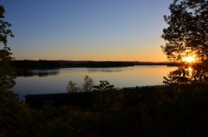
Lake Onalaska at sunset

Lake Onalaska near sunset

I enjoyed my ride on the Great River Trail last week although, as I mentioned above, I did not leave quite enough time to ride the distance that I had planned (64 miles both ways) and I had to rush more than I would have liked and ended up riding the last 5 miles or so in the dark (with no bike light, of course)

Fortunately, the trail itself was in great shape (very flat and well groomed) and was straight and flat so it was not as bad as riding a poorly maintained or more difficult trail in the dark.

I have included photos in this blog post of Lake Onalaska from early afternoon and at sunset from the pictures that I took on this ride. It can be a little difficult getting early evening photos of Lake Onalaska from the trail since you are looking west and right into the sun.

For a more detailed update and/or for the full Photo Tour of this ride see the Great River Trail link above or see The Great River Trail Photo Page 3 (here) to go directly to the photos from this May, 2014 ride.