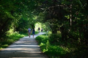
Flooding on West Side of Paul Douglas Trail

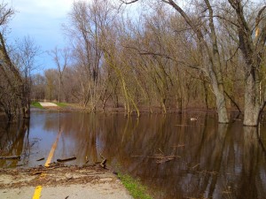
I was just out to the bike path that goes around Paul Douglas Forest Preserve (in Hoffman Estates (on Monday 4/29)) and discovered that the trail is flooded once again on the west side of the trail (the part that runs parallel to Huntington/Freeman Road).

Pauld Douglas Bike Trail Flooding

The flooding on the west side of the Paul Douglas Bike Trail.

This part of the trail has flooded quite a few times and I have even written about it before here. It makes sense that this part of the trail would be flooded with all the other flooding that we have had in the area this year.

It actually used to flood a little worse in the past than this time (although it may have been worse before I made it out to the trail this time). They actually dug up this part of the trail shortly after it was built, added a few large drainage pipes under the trail and re paved it again to help with the flooding but it was not completely successful (although it did help a little bit).

The photo that I have included here is from my iPhone and shows how the trail looks as you are looking down the trail from south of the flooded part (looking north). There were even a few geese swimming around on the trail when I was there! You can see one of them in the photo in the distance on the right.

You can get around this part of the trail fairly easily by crossing over the Huntington/Freeman Road which it is right next to the trail at this point and it is just a very short detour. As I was taking the photo here I saw one rider go down to the flood and it looked like he was going to ride through it but he chickened out and ended up going around.

You can see the yellow line (from the trail) through the water and I believe that it is only about 4 inches deep so if you are adventurous (and don’t mind getting your feet wet) you can ride through it too. I have done this in the past (although I was on foot in this case).

That’s it for now… I’ll have more trail updates when I am able to ride more.

Deer Grove Orange Trail Conditions, about-bicycles updates…

I was just out on the Orange Trail in Deer Grove yesterday and wanted to post an update on the condition of the trail since there were some downed trees. The Orange Trail is the old abandoned forest preserve road that they closed to automotive traffic. I actually remember many years ago when you could drive on what they now call a trail but that was quite a while ago. You get on this trail from the entrance off Dundee Road just east of Northwest Highway.
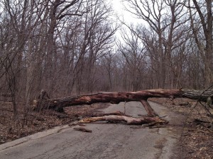
Fallen Tree in Deer Grove

The first tree over the Orange Trail

The Orange Trail is not very long (a little over a mile one way) but it is one of my favorite trails in Deer Grove and can be used to get from one trail (or road) to another. I walked the trail yesterday since I have been unable to ride so far this season due to an injury (my physical terroristย  ๐Ÿ™‚ has now given me permission to start riding short distances again so I should be back in the saddle again for this season soon).

Anyway, what I discovered yesterday is that there are 2 huge trees that have fallen on to the trail and I don’t believe that you can ride around them on a bike without stopping and either walking around or under them. The trail was also under water on one side in one of the ravines but you could still get by easily on the other side. The trees that were on the trail look like they fell over due to all the rain and flooding and the wet ground since you could see how their roots came out of the ground.
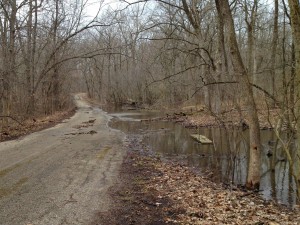
Flooding on Orange Trail in Deer Grove

The high water over some of the trail

They maintain the trails in Deer Grove pretty well (it’s a Cook County forest preserve) so I imagine that they will get out there and get these trees off the trail eventually but I don’t know how long it’s going to take them to get to it. So you just need to know that if you ride on this trail there are some obstructions that you’ll need to get around.

We have had a lot of flooding in the Chicago area this week so I was worried about flooding on the trails. This trail in Deer Grove was not bad but I know there has been flooding along the Fox River and the Des Plaines River so I’m sure parts of those bike trails are flooded too.
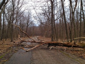
More fallen trees on Orange Trail in Deer Grove

The second fallen tree on the Orange Trail

The river does not have to be that high to flood the underpasses on the Des Plaines River Trail. I’ve seen that happen before as in theย photos on this page.

About-Bicycles Updates

Sorry about the long time between posts here, I am usually much more active with this blog. Although we have not had the greatest riding weather recently, we have had a few good riding days but as I mentioned above I have had an injury that has prevented me from riding so far this season.

The main reason though that I have not been on schedule with my blog updates and have fallen a little behind on a few other updates to the site is because I am still trying to recover from the last Google Bashings that this site has had.

I have mentioned this before in some of my other posts but if you missed it we lost a large amount of traffic to this site with the recent Panda and Penguin updates from Google. We still rank higher in the Search Engine Results for Bing and in a lot of cases I have found the Bing results to be more relevant.

It seems to me that Google is ranking the popular super-sites on the internet higher on most search terms regardless of how relevant the specific results are. For example, you always see Wikipedia, You Tube, Amazon, TrailLink (for bike trails), Flickr (for photos), etc. even when they don’t match the specific term that you are searching for. Plus often you get multiple (like 10 or more) search results for the same website (let’s have some variety!).

OK, I could ramble on a lot more about Google’s degraded search results but I need to get back to the topic that I was originally discussing.

One of the penalties that you get with the Google Panda update has to do with “Thin Content” and I think there is a possibility that my bike trail photo pages may have inadvertently caused me problems in this area.

The bike trail photo pages on this site were designed simply to showcase the bike trail photos with very brief captions on most of the photos. Well, I discovered that we have about 250 photo pages on this site and most have very little content because they were designed that way.

No one really knows what the exact Google algorithm is for their search results (except for the people at Google) but I have read that pages with less than 300 words as content could get penalized by Google and if there are a large number of these on your site it could cause problems. Well I have a very large number of photo pages with very little content other than very brief captions.

So anyway, one of the main things that I have been working on is increasing the content on these pages so I am backtracking and adding much more commentary to all the bike trail photo pages and this has been slow and time consuming.

In some cases the additional content just looks like “fluff” but I have discovered that adding more verbiage does actually add more depth the the photos and articles and can be helpful too in many situations.

Well, I knew that this topic was going to be hard to explain and I’m afraid that this part of the post got longer than I intended.

For those of you who made it this far and were interested, I hope that this explains why there hasn’t been many blog posts recently and that I am still working hard to recover from the latest Google bashings so I can continue with more relevant and quality updates to this website.

Intense Color Bike Trail and Nature Photos

I’ve been taking bike trail photos ~ and writing the corresponding bike trail articles ~ for this website ~ for about 10 years now. My original photos were actually pretty lame (in retrospect) but since this is something that I really love to do, I kept working at it, upgraded my photo equipment and improved a lot over time (I think anyway).

Spider web along Des Plains River TrailI have also had photo contributions to this site from other cyclists and photographers, most notably Dale Kiffel who has contributed some very high quality bike trail and nature photos to this website ~ like the (color enhanced) spider web photo ~ from the Des Plaines River Trail ~ on the left.

Like most other photographers these days, I have also used Photoshop and other photo editing programs to enhance the original photos. In the past I had mostly used the photo editing programs for some minor cropping or other very limited changes.

Low Profile photo of Deer Grove Bike TrailThese days I have noticed that quite a few photographers, at various levels, use photo editing programs pretty extensively and many of the most dramatic photos that I see out on the internet look like they have had the colors enhanced.ย  In some cases it’s just a touch other times it is quite extensive.

Of course, it is best to get everything right in the camera prior to taking the photo and not have to depend on photo editing programs but even when you do get a really good photo you can sometimes make it even better in the lab (as I call it).

Last summer I got my first DSLR camera and have been working on getting much higher quality photos for this website. I believe that I have improved quite a bit and I have found that, in some cases, enhancing the colors on the bike trail and nature photos can improve the photos quite a bit although you still need to start with good photos to begin with.

In the past, I have usually used the color enhancements very conservatively (and I usually mention this with the photo article) just to make the photos stand out a little more and to be a little more interesting.

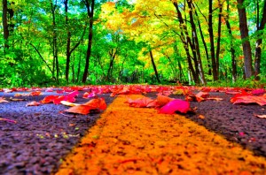
Recently, I have seen some HDR (High Dynamic Range) photos in addition to some just heavily edited photos out on the Internet that were very striking. So I decided to try this with some of the bike trail and nature photos that I have in my collection and/or have posted out on this website.

So you can find our collection of Intense Color Trails and Nature Photos here.

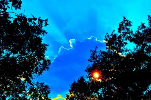
Dramatic Sunbeams from Millennium TrailMost of these photos have been posted previously on this website under the corresponding Bike Trail Pages. The selection that I used includes some of the best and most colorful photos posted in 2011 and 2012.

I’ve used varying degrees of color saturation for this collection of photos. In some cases the saturation is not that high in other cases the enhanced photo looks almost cartoon like (like the second photo on the first photo page).

As I was working on the color enhanced photos it reminded me of that old SNL skit where Christopher Walken kept trying to get MORE COWBELL on the Blue Oyster Cult song. I kept wanting MORE COLOR! (I hope I got better results than they did with the Cowbell on the BOC song though ๐Ÿ™‚ ).

So now that I have these Extreme Color photos posted, I’ll check and see how you all like them by the internet traffic to these pages and the “Likes”, “Tweets”, etc. that we get. If I see that these photo pages are popular then I’ll probably some color enhanced collections for the future trail pages that I post.

Note: I have social media buttons at the bottom of each page on this website so if you like these photos please add a “Like” or a “Tweet” etc. at the bottom of the Intense Color Photo Pages.

Thanks, Rob.

Road Bike Rider in the Snow and Photo Stuff

I just wanted to mention an unusual kind of thing that I saw this weekend when I was out on the bike trail behind my house working on a Photoshop project that I wanted to try for my personal FB profile picture (also an unusual kind of thing).

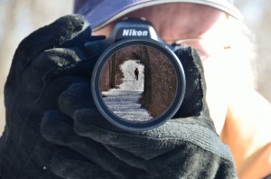
I was out on the bike trail with my camera, a mirror and a tri-pod in order to get this in-camera-lens photo that I tried one other time on a birthday card. Fortunately there was no one else out there because of all of the snow on the trail since I think my situation would have looked pretty quirky to anyone else that might have been there. Road Bike on Trail in the Snow

Well, I shouldn’t say no one else was out there because after I finished my photo project and as I was packing up my stuff this cyclist on a road bike rode by! There was a good few inches of snow on the trail and this guy was on a road bike with very skinny tires (and was managing to stay vertical).

As this cyclist was riding by I said “wow, in the snow?”. All he said was “this wasn’t planned“. I have no idea what that meant or how he could have been on his bike on a bike trail and it not being planned but that’s what he said.

As he was riding off into the distance I realized that I had my camera right there and that this is something I should have a photo of. So I got a photo of this rider as he was going up a fairly steep hill on this trail.

The photo that I have included above uses the “in-camera-lens” effect that I was working on out on the trail and the photo of the bike rider (within the camera lens). I’ve included the larger blowup of this photo so you can see it better if you click on the photo.

Well, I completed the Photochopping for my FB profile picture, uploaded that and I got quite a few comments and likes on the photo effect (even though it had a picture of me in it too ๐Ÿ™‚ ).

I don’t want to overuse this effect but I think that I am going to update the About-Bicycles Facebook page to use something like this too soon.

BTW: if you do a LIKE on our FB page (the link above) then you will also get notifications when there are updates to this blog since I have it set to update the FB page whenever I do a blog post here. Or you could even read the blog posts out on FB if you prefer.

If you would like to know how this is done in Photoshop (it’s not difficult) just post a reply here or send me an email and I’ll give you the details.

I&M Trail from Marseilles to Split Rock (near La Salle)

As I mentioned recently, we just rode another part of the I&M Canal Trail last week (Monday, 10/15/12) and I have selected and posted photos of our trip with our existing bike trail pages.ย Illinois and Michigan Canal Trail and Bike Ride

This particular ride was a continuation of a ride on the I&M (Illinois and Michigan) Canal Trail that we did way back in 2003 from Channahon to Marseilles. The photos for this trip should be much better quality since the old photos were actually from a pre-2003 generation camcorder and the new photos are from our fairly current DSLR cameras.

These trail photos are more like my usual photo tours of the other bike trails written up on this site, where I provide more information on the trails and try to capture the feel of the entire ride, rather than the photos that I did recently that were specifically meant to capture the fall colors on the bike trails that I selected for this year (although there were still some nice fall colors on this I&M Trail ride).

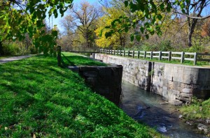
We did a little over 40 miles on this ride and once again I was impressed with many parts of the I&M Canal Bike Trail. This is a fairly rugged (if you are used to asphalt) multi-surface trail. Most of the trail was crushed stone but there were also some grass and dirt sections. We had to clear and/or carry our bikes over some fallen trees on one part of this ride. Lock on the I&M Canal Trail west of Ottawa

After our first ride on the I&M Trail I did some research on the history of the I&M trail (both online and at the library) and I have been very impressed with the significance of the history behind this trail (once the Illinois and Michigan Canal that connected Lake Michigan with the Mississippi River and shaped the history of Chicago and the mid-west US).

On this trip we rode past the Fox River Aqueduct and Locks #11 and #12 just west of Ottawa, Il. There are quite a few signs and maps posted along the trail that give you some of the history of the part of the trail that you are on. so not only is this a nice, scenic bike ride, you can also pickup some interesting history on this ride.

The I&M Trail goes right past Buffalo State Park which seemed like a nice area but we did not get a chance to go into the park. The trail is also just north of Starved Rock State Park but I did not see a way to get to Starved Rock from the I&M Trail. This is probably possible but we had a limited amount of time (there is only so much daylight this time of year) and we were not able to explore as much as I would have liked to.

OK, enough talk about the I&M Canal and our ride. Here are the latest photos from our ride from Marseilles to Split Rock (7 photo pages):

Actually, you can just take the links at the bottom of each photo page to go to the next one, but I am including all of them here in case you are interested in a particular part of the trail.


Millennium Trail Fall Photos

I have been trying to get out on some more bike trails for photos ~ as well as to enjoy the rides and scenery ~ and I now have some more fall scenery photos posted on this site and more trail info and photos to come soon.

First, I rode a section of the Illinois and Michigan Canal bike trail (I&M Trail) from Marseilles to just before La Salle, Il. with a friend on Monday. This was a continuation of a ride that we did way back in 2003! This was a really nice ride and I have plenty of photos but I do not have these uploaded just yet (I will have this done in a few days and will post another blog entry when they are complete). Fall Colors on the Millennium Trail

Next, since it was another nice day on Tuesday, I decided to pick another wooded bike trail that I already knew about for some fall color photos (and a ride, of course).

I choose the Millennium Trail this time and have selected and posted my photos from this ride on the following pages. See Millennium Trail Fall Photos 6 ~ Lakewood Forest Preserve and Millennium Trail Fall Photos 7 ~ One Mile Loop for the photos from this ride.

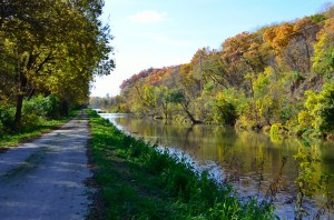
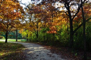
I thought that the trees might be pretty bare already since it is getting a little past peak fall color season but I found that there was still plenty of color out there when you look for it. It seems like earlier in the fall the trees have more leaves and you get more greens and yellows but later in the season although many of the leaves have already fallen there are still trees with leaves and it seems like there are more reds and browns at this time.

Enhanced Photos

One thing that I wanted to point out with the photos is that after selecting the best of the photos that I took I also enhanced them a little with my photo editing program. In most cases I boosted the color just a little, straightened the photos that were crooked and cropped a few.

This is a pretty common thing to do these days and I still try to keep the photos looking as natural as possible and like the original scene looked. I just consider this making a good photo better but for artistic honesty, I think you should be aware that they were touched up a little (no, I am just not that great of a photographer (without a little help anyway)).

Trail Conditions

I also wanted to mention one thing about the current condition of the Millennium Trail. They are currently doing construction on some parts of the trail right at the Lakewood Forest Preserve parking area off of Fairfield Road.

When I was there on Tuesday they had just paved the trail right by the parking lot and you could only go a short distance before it was blocked off. At that time you needed to cut through the playground area and get to the main part of the trail in the Lakewood Forest Preserve.

I also noticed that they made a new section of the trail that now goes north (from the parking lot) and through a tunnel under Route 176. I’m not sure exactly when this will be complete or where it will ultimately go but it’s nice to see that they are expanding the trail and adding highway underpasses.

I am also curious just how much of this trail they are going to pave. Personally, I don’t mind the crushed stone but, for the most part, having the trail paved will probably be a nice improvement.


Fall Colors and Bike Trails ~ Des Plaines River and North Branch Trails

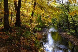
Although I haven’t been on any new bike trails recently, I just had to get out and enjoy the fall colors on some of the more wooded bike trails that I knew about and had already ridden and to get some autumn bike trail photos for this site. Fall Colors on the North Branch Trail

We are pretty close to peak fall color season here in the Chicagoland area ~ I’m not sure if we are a little past the peak or if it is going to get even better but it was definitely nice enough for some beautiful trail rides.

I had quite a few choices for wooded trails and I initially chose The Des Plaines River Trail (near Euclid / Lake Street) and the North Branch Trail (south of Lake Street). My other runner-ups were Busse Woods,ย  Millennium Trail (south end) , the Moraine Hills trails and the Fox River Trail. I’m sure there are others too but there is only so much time for trail riding (even in peak fall color season)! ๐Ÿ™‚

Most of the time when I ride a new bike trail ~ or parts of a trail that I had not been on ~ and bring my camera my goal is to photograph and document as much of the trail as I can (and try to get get quality photos).

My goal for the bike trail photos that I just took was to capture the fall colors and maybe even get some creative shots. So these photos do not cover a specific route as much as just give you the feel of riding these trails in the fall. It’s all about the colors!

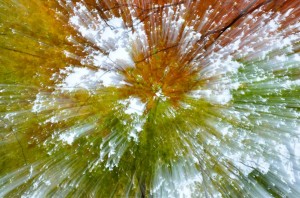
Creative Fall Colors from Des Plaines River TrailThe photo on the right is one of my more creative fall color photos. This one is one of the mushroom photos in the Des Plaines River Trail photo pages (you’ll know what that means if you check out the photo pages).

So without further yaking here are the new Fall Color Bike Trail Photo Pages: See the Des Plaines River Trail Fall Photos here (3 pages) and see the North Branch Trail Fall Photos here (2 pages).

A little bad news for me and other small businesses on the Internet…

It was really nice to be able to get out and enjoy some scenic fall bike rides and I needed that after the bashing that my websites (including about-bicycles.com) took from Google recently.

Google does updates quite often to try to improve their search results. A lot of the time they succeed and their search results improve. Other times they get worse.

The about-bicycles.com bike site took a big hit with the last round of Google updates and the traffic to this site has dropped significantly. We used to get over 3,000 visitors per day in peak cycling season. It is much less now but fortunately we still show up in the search results fairly well (unlike some other small businesses that were basically ruined by this update).

Google used to state that they supported small businesses and individual website owners but it appears that they are now favoring big business. Just check out the search results and see how many times you only get the largest internet sites and little if any smaller sites (often low quality too).

OK, sorry about rambling on about this but I do have a reason for mentioning it here.

If you like any of the pages on this website, like the new fall photo pages that I just posted, please “Like”, “Tweet” or use one of the other social media buttons at the bottom of each webpage on this website. This will not fix all of the damage that the Google update did to this website but it will help a little and every little bit helps.

At least a lot of our pages that got dropped still show up on Bing and Yahoo! (just an FYI if you want to help break Googles Big Business Monopoly) :-).

The Illinois Great River Trail Description, Info and Photos

Although I have not personally been out on any new bike trails recently (to report on) one our our website visitors had just ridden the Illinois Great River Trail ~ from Moline to Savanna, Illinois ~ and was nice enough to share his detailed (57 mile) ride information with us.

I was actually just looking into riding this trail a little while back so I was very interested in hearing what this trail was like. Our website visitor, Carlos of Chicago, initially sent a brief email telling me of his recent ride on the Great River Trail. I asked for a little more detail (just to see if it was a trail that I may want to ride sometime) and I was quite surprised at the detailed ride report that I received!

I received a well written and very detailed description of his ride(s) on the GRT and even a few photos taken from the trail and surrounding area. I asked Carlos if it was OK to post his article and photos and he agreed that it would be OK.

Here is a link to the NEW Illinois Great River Trail Ride Report and Photos that we just received and posted.

I often see this trail refereed to as simply “The Great River Trail” but I remember posting another bike trail article on the Great River Trail, in Wisconsin, some years back, that also runs along the Mississippi from the Onalaska to Marshland in Wisconsin, which is why I usually specify that this is the Illinois Great River Trail.

I hope you enjoy the new Great River Trail article and thank you Carlos for sharing this information with us!

New GPS Bike Trail Maps for Palatine Trail and Deer Grove Trail (partial)

This is just a quick update to let you know that I just posted some new, interactive GPS bike trail maps for the Palatine Trail and the connecting Deer Grove Trail (black trail and red trail sections).

I have ridden these trails many times in the past and have had the bike trail pages (and old photos) for both of these trails out on this website for years now (actually they need an upgrade too) but I never really had good maps for either of these trails posted with the articles. I’ve linked to a nice PDF map of the Deer Grove Trails but I also like the interactive GPS maps because you can zoom in, zoom out, move around or even switch to the satellite view to see the actual terrain.

So now, I have the GPS maps available. You can find the GPS maps (and info on the trails) at The Palatine Trail and the connecting Deer Grove Bike Path. The photos on these pages are very old so I apologize for their low quality. One thing that is interesting though, since these photos are very old, is that you can see how some parts of the trail have changed quite a bit over the years.

I recently noticed how they really thinned out the woods on the east part of Deer Grove now. This is a little disappointing if you remember how beautiful the thick woods along this part of the trail used to be. The signs in that area suggest that they are doing this maintenance to help the eco system in the long run. I hope they know what they are doing.

One final note, I usually post the condition of the various trails that I ride so I can let you know that the Palatine Trail and the Black and Red sections of the Deer Grove Trail are in very good condition and there is no construction or detours.


Des Plaines River Trail ~ Park Ridge to Wheeling

This might look like a repeat of one of my earlier bike trail ride reports but it is actually something completely different. I have ridden on the Des Plaines River Trail (DPRT) many times now and have documented the trail and uploaded the photos (and more recently the GPS map data) before. My last ride on the DPRT was actually only a month ago. Des Plains River Trail, DPRT, Cook County

Well, the Des Plaines River Trail is actually a really long trail (approximately 60 miles) and although I have ridden on many different parts of the trail I have never ridden the entire trail or the section that we just rode last week which includes Wheeling, south of Dundee Road, to Park Ridge (and back).

This part of the DPRT is mostly wooded, shady with some open areas and has some very nice scenery but there are also some fairly rugged sections in this area. Most of the trail is crushed stone but there are parts that are packed dirt and even a few single-track sections.

The only thing that I didn’t really like much on this part of the trail is that there are a few busy roads that you need to cross where there are no bridges, underpasses or even traffic signals in some cases. Milwaukee and Oakton (I think) were the worst to cross. This would not cause me to not ride this part of the trail but it does make it a little more difficult especially if you ride this part in rush hours (yes hours is plural and there is more than one ๐Ÿ™‚ ).ย Most of the major roads do have bridges, underpasses or at least traffic signals where you need to cross.

One of the nice things about this part of the trail, aside from the shade and nice scenery in some parts, is that if you are coming from the north (the DPRT goes almost to the Wisconsin border) you can extend your ride quite a bit. I have never ridden the DPRT from Park Ridge south to Maywood but I understand that it does go that far. So if this is correct, and the entire length of the trail is 60 miles (which I have read) then you could actually do a 120 mile round-trip ride on this trail!

I know from experience riding the Lake County part of the Des Plaines River Trail that the underpasses can flood and even parts of the trail can flood when the river is high (like in early spring or after a lot of rain (not like now, of course)) so I think it is probably best to ride this part of the trail when conditions are dry. This past week was perfect for the part of the trail since the shade kept us cooler and everything was very dry.

Of course, I brought my camera and Bike GPS so I could take photos and document this part of the DPRT. Actually, with all the original photos that I have posted of this trail and the new ones that I just took I am starting to wonder if I have too many photos of this trail! Well, even if that is the case, I think it’s nice to be able to see what the different parts of the trail are like, especially if you are considering riding the trail and you can just skip the sections that you are not interested in.

As I was posting the latest trail photos I was looking at some of the original photos of the trail that I took back in 2004. Man, it’s nice that digital camera technology has come such a long way. Sorry the older photos are not very good quality. I guess I’ll have to re-do the photos of those sections when I get a chance.

Anyway, the new section of the trail that we just rode last week starts with the Des Plaines River Trail Photos 12 (which starts in Park Ridge) and includes Photos 13, Photos 14, Photos 15 and Photos 16 as we headed north back to Wheeling (like I said I have a lot out there now).

Most of my photos are related to the bike trail itself but my friend Dale, who rode this part of the trail with me, likes and is very good at nature photos and more artistic shots and I have included some of his photos in the collection too.

So I hope you enjoy the new photo pages and get a chance to get out to the DPRT or any of the other nice bike trails in this area or that are convenient for you.

Mobile Friendly Websites

On a different subject (but slightly related), I have been working on converting all of the pages on this website to a more mobile-friendly format for those who access this site with mobile devices (smart phones, tablet computers, etc.).

This has been quite a project so far and I still have a long way to go (but getting closer). The website will look almost exactly the same for anyone accessing the site with a desktop or laptop but will be much more streamlined for smaller devices like smart phones. This should include most of the bike trail pages and eventually this blog too so stay tuned (especially if you are on a smart phone!).