Des Plaines River Trail ~ Park Ridge to Wheeling

This might look like a repeat of one of my earlier bike trail ride reports but it is actually something completely different. I have ridden on the Des Plaines River Trail (DPRT) many times now and have documented the trail and uploaded the photos (and more recently the GPS map data) before. My last ride on the DPRT was actually only a month ago. Des Plains River Trail, DPRT, Cook County
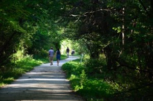
Well, the Des Plaines River Trail is actually a really long trail (approximately 60 miles) and although I have ridden on many different parts of the trail I have never ridden the entire trail or the section that we just rode last week which includes Wheeling, south of Dundee Road, to Park Ridge (and back).

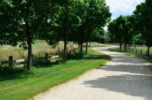
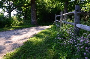
This part of the DPRT is mostly wooded, shady with some open areas and has some very nice scenery but there are also some fairly rugged sections in this area. Most of the trail is crushed stone but there are parts that are packed dirt and even a few single-track sections.

The only thing that I didn’t really like much on this part of the trail is that there are a few busy roads that you need to cross where there are no bridges, underpasses or even traffic signals in some cases. Milwaukee and Oakton (I think) were the worst to cross. This would not cause me to not ride this part of the trail but it does make it a little more difficult especially if you ride this part in rush hours (yes hours is plural and there is more than one 🙂 ). Most of the major roads do have bridges, underpasses or at least traffic signals where you need to cross.

One of the nice things about this part of the trail, aside from the shade and nice scenery in some parts, is that if you are coming from the north (the DPRT goes almost to the Wisconsin border) you can extend your ride quite a bit. I have never ridden the DPRT from Park Ridge south to Maywood but I understand that it does go that far. So if this is correct, and the entire length of the trail is 60 miles (which I have read) then you could actually do a 120 mile round-trip ride on this trail!

I know from experience riding the Lake County part of the Des Plaines River Trail that the underpasses can flood and even parts of the trail can flood when the river is high (like in early spring or after a lot of rain (not like now, of course)) so I think it is probably best to ride this part of the trail when conditions are dry. This past week was perfect for the part of the trail since the shade kept us cooler and everything was very dry.

Of course, I brought my camera and Bike GPS so I could take photos and document this part of the DPRT. Actually, with all the original photos that I have posted of this trail and the new ones that I just took I am starting to wonder if I have too many photos of this trail! Well, even if that is the case, I think it’s nice to be able to see what the different parts of the trail are like, especially if you are considering riding the trail and you can just skip the sections that you are not interested in.

As I was posting the latest trail photos I was looking at some of the original photos of the trail that I took back in 2004. Man, it’s nice that digital camera technology has come such a long way. Sorry the older photos are not very good quality. I guess I’ll have to re-do the photos of those sections when I get a chance.

Anyway, the new section of the trail that we just rode last week starts with the Des Plaines River Trail Photos 12 (which starts in Park Ridge) and includes Photos 13, Photos 14, Photos 15 and Photos 16 as we headed north back to Wheeling (like I said I have a lot out there now).

Most of my photos are related to the bike trail itself but my friend Dale, who rode this part of the trail with me, likes and is very good at nature photos and more artistic shots and I have included some of his photos in the collection too.

So I hope you enjoy the new photo pages and get a chance to get out to the DPRT or any of the other nice bike trails in this area or that are convenient for you.

Mobile Friendly Websites

On a different subject (but slightly related), I have been working on converting all of the pages on this website to a more mobile-friendly format for those who access this site with mobile devices (smart phones, tablet computers, etc.).

This has been quite a project so far and I still have a long way to go (but getting closer). The website will look almost exactly the same for anyone accessing the site with a desktop or laptop but will be much more streamlined for smaller devices like smart phones. This should include most of the bike trail pages and eventually this blog too so stay tuned (especially if you are on a smart phone!).

 

North Branch Trail ~ Ride and Photos from Glencoe to Chicago and Back

I finally got a chance to ride the entire North Branch Trail (15.5 miles one way) from Dundee Road (in Glencoe) to Devon Ave. in Chicago. Although I had ridden the northern part of the trail before I had never ridden the entire trail.

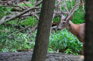
Deer in Miami Woods along the North Branch Trail

A deer in Miami Woods along the North Branch Trail

Actually, I really started on Lake-Cook Road north of the Chicago Botanic Gardens and rode through the Botanic Gardens to get to the northern end of the North Branch Trail (NBT). Although the NBT article is about the North Branch Trail, and not the Botanic Gardens, I also included a few Botanic photos too since this is a additional benefit to riding this trail.

On the North Branch Trail I was actually surprised at how you feel like you are totally out in the deep woods when, in reality,  you are actually never far from all this “civilization” around us. Although this trail has bridges over some of the main roads in this area there are some busy roads that you still have to cross and that reminds you about where you are until you ride off into the woods again.

The North Branch Trail winds through the northern suburbs of Chicago (including Niles, Morton Grove, Glenview, Northfield and Glencoe) and into the far north end of Chicago (into the Edgebrook neighborhood) following the North Branch of the Chicago River on the southern part of the trail and the Skokie River on the northern part of the trail.

This bike trail is all paved and in good condition, which is very nice, and the woods and scenery are also really nice. I rode the trail on a weekday so it was not too crowded but I know, from the last time that I rode the trail (and from what other people have told me), that this trail can get very crowded at peak times (which is not so nice). The only other thing that I did not like about this trail is that there are a number of busy roads that you need to cross. Although there are lights and crossing signals at the busy roads, you still have to wait and deal with traffic.

Even with the trail traffic and road crossings, this is still a very nice trail and I would recommend it for a good 30 mile bike ride (both ways) plus, as I mentioned you also have the option to ride into the Botanic Gardens, at the north end, which is great and can be a good photo-op (if you have a camera with you). You can see the full North Branch Trail Article and Photos here.

In the southern part of the trail, in the Miami Woods section, I stopped for a photo and happened to see a couple of deer near by (the photo above). They seemed very unconcerned about my presence. Posed for me a little then casually crossed the path right in front of me. Later I read (in Wikipedia) how the deer in these woods have been protected for many generations and have little fear of humans.

On one of my usual rides through the Paul Douglas forest preserve, a few days later, I also saw  at least 6 deer but in this area the deer acted as I expected. Once you got too close to them they took off.

When I finished riding the trial I crossed Dundee Road and rode through the Chicago Botanic Gardens. I was really enjoying taking photos at the Botanic Gardens in the early evening (just before sunset) but unfortunately for me, I parked in a forest preserve parking lot (on Green Bay Road) that closes and locks up at sunset and I was really nervous about my car getting locked in the forest preserve (actually, I think that is an on-going phobia of mine even though it’s never happened to me. I wonder how you would get you car out if they chained up the entrance… ?)

Anyway, if you are looking for a nice wooded and scenic trail in this area, see the North Branch Trail Article for the full trail article, ride report, photos and interactive GPS map of this trail and my ride.


Moraine Hills Bike Trail ~ Photos and Ride Report

I have been wanting to check out the trails in the Moraine Hills State Park (just south-east of McHenry) for a while now and finally had a chance to ride the trails last Tuesday (7/3). This was during our heat wave and our drought but the ride was still scenic and it is a really nice area for a fairly short ride and photos.

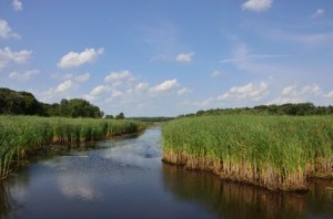
Wetlands and stream into Moraine Hills Park

Wetlands and Stream in Moraine Hills State Park

I had my camera and GPS Bike Computer with me so I could post photos and document the ride of course and I have posted quite a few photos, along with the bike trail article on this trail here at the Moraine Hills Bike Trail Photos and Ride Report.

As I was updating my photos and the article on this bike trail I searched for other photos of this park and trail and found that it looks quite different at different times of the year. My photos are from a drought in the middle of summer but the scenery looks quite different in the spring, fall and winter. I hope to make a few more trips out there in the different seasons to check out the contrast. When I do, I’ll try to add some updates to the new Moraine Hills Trail pages.

Where I parked, at Pike Marsh (on the south-eastern part of the park), you can get on the main Moraine Hills Trail and the River Road Trail which runs mostly parallel to the MHT at that point . I accidentally got on the River Road Trail and took a 3 mile detour when I first started. This was still the same are and it was also a pretty nice ride but it was not on the actual Moraine Hills Trails.

When I got back on the main trail again I headed south-west first to the Fox River and the McHenry Dam and then around the Black Tern Marsh. This area looked nice but I stopped at one point, close to the marsh and got attacked by some kind of flies. I had to get

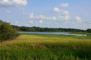
Lake Defiance in the Distance

Lake Defiance in the Distance

moving again to ditch them. Later I stopped by the Black Tern Viewing Platform, which was very nice (and no flies) and took some photos.

After that, I headed north again (to the other side of River Road) and rode both loops on the northern part of the park. The loop on the west side goes into what they call the Northern Woods and goes around the Leatherleaf Bog Nature Preserve and the loop on the east side goes around Lake Defiance.

I picked up a map of the park and trails at the park entrance which I have scanned and posted on the Moraine Hills Trail article (the link above) along with the GPS map of my ride (including the River Road detour).

As for the trail itself, it is a combination of crushed stone and paved surfaces (mostly crushed stone) and was in very good condition. There is also a combination of hills and flat lands. Most of it is fairly flat with a few steep hills mostly in the northern section (you can actually see the hills and elevations on the GPS map of my ride that I posted with the article linked to above (using the “Player”option on the Garmin page).

Well, that’s about it for this ride (until I check it out in another season). If you are looking for a fairly short, leisurely ride in a nice park with some nice scenery to enjoy or photograph then you may want to check out the Moraine Hills State Park Trails.

Evanston Lakefront Bike Paths ~ Wilmette to Chicago

I was finally able to get out to the Evanston Lakefront Bikeways earlier this week for a ride, photos and ride report. It was a little windy but still a beautiful day on Monday when I rode the Evanston Bike Paths.

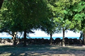
Evanston Lakefront Bike Path

Lake Michigan as seen from the Evanston Lakefront Bike Path.

I often refer to this route as “bikeways” since this is not really a specific bike path but a series of bike paths, a bike lane on Sheridan Road, roads through Northwestern University and even sidewalks that you need to ride on to get through all of Evanston along Lake Michigan.

I started my ride in Wilmette ~ around Gillson Park ~ rode down Sheridan Road to Northwestern University ~ where you can get on a bike path right next to Lake Michigan ~ through Evanston and even into Chicago where I turned around at Rogers Avenue Beach.

Most of this ride is very nice although it is not a bike path the entire way and you need to hop on to roads and sidewalks to get through Evanston. I think that the best part of this bike route is the bike path that starts at Northwestern University and goes south to Lee street. This part is almost all paved and right next to Lake Michigan although is is only a 2 mile stretch.

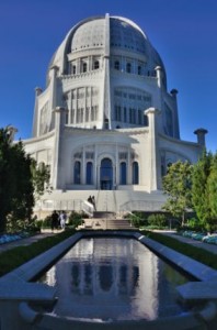
Bahai temple in Wilmette

The Baha'i temple in Wilmette

Another nice thing about this bike route is that you can connect to the Green Bay Trail at the north end or to the Chicago Lakefront Bike Path on the south (although you need to ride about a mile and a half in the city to get to it).

I brought my camera and GPS bike computer to document the ride and post it here, of course so you can read all about this bike path ~ and see the photos ~ at the new Evanston Lakefront Bikeways page.

I really enjoyed this ride and I always love being out by Lake Michigan (especially on really hot days) but one of my favorite parts of this ride was my side trip to the Baha’i temple in Wilmette for photos and my ride to the beach at Gillson Park (also in Wilmette). The Baha’i temple is a beautiful building and I actually spent a lot of time at the beach at Gillson Park when I was younger and I still like it there.

Since I had my camera with me for the bike ride photos, I took advantage of the photo op at the Bahai temple and I also posted quite a few photos of this landmark building on the last photo page for this ride. This is probably one of my favorite bike trail photo pages now even though most of it is not actually on a bike trail. You can see these photos here at the Evanston Lakefront Bike Path Photo Page 4.

I have been aware of the Bahai temple and knew where it was for many years but I never actually went over to it for a closer visit. I was glad that I did on this trip. The building, architecture, and exterior decorations are beautiful and made for some good photos.

Although I had heard of the Bahai faith ~ mostly because of some songs on a Seals and Crofts album (they wrote and recorded the song “Summer Breeze” and were Bahai followers) ~ I ended up looking up a bunch of information on the religion and on the temple in Wilmette on the internet when I got back and was posting the photos and bike ride article.

I thought that it was really interesting that some of the columns on the temple were decorated with swastikas along with the star of David and the Christian cross.  After looking this up on the internet I found that the swastika has been around for centuries and has been used as a symbol good things for various religions and civilizations long before it was used as a symbol for hatred and racism by the Nazis.

Well that’s it for the Evanston Lakefront bike ride. This is prime-time bike riding season so I’ll be selecting, riding and reporting on another trail soon and hope that you cyclists out there are also able to get out and enjoy some good riding!

Des Plaines River Trail ~ Lincolnshire to Dundee Ave in Wheeling

I have wanted to check out the gap in the Des Plaines River Trail (DPRT) just south of Lincolnshire for quite some time now and made it a priority since some visitors to this site had organized a 61 mile ride in the surrounding area and were planning on using this part of the trail for the ride and I offered to see if you could get through or not.

I discovered that, although there is a 1/4 mile gap in the trail it is shorter than it used to be and much easier to get around than it was a few years back when I had ridden on this part of the trail.

DPRT South of Lincolnshire

Des Plaines River Trail around Lincolnshire

It was also a beautiful day for a ride on Friday and I did a nice, scenic 12 mile ride on this part of the trail which included sections that I had never been on before.

I brought my camera and bike GPS (of course) since I needed to document the gap in the trail and I had planned to ride another trail in Evanston later in the day.

After I discovered that I could get through the 1/4 mile gap I just decided to ride further south on the DPRT and photograph and document this part of the trail for this website since I had previously only ridden and written about the northern parts of this trail ~ from Lincolnshire north to the Wisconsin border.

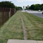
Dirt Bike Path next to Milwaukee Ave.

Dirt Bike Path next to Milwaukee Ave.

The Gap in the Des Plaines River Trail

As for the gap in the trail, it is around Lincolnshire just south of the 28 Mile marker on the trail (as you head south) and the signs direct you out to Milwaukee Avenue. Milwaukee Ave. is a busy and major road but there is a sidewalk on one side and a dirt path, next to the road, on the other side (see the photo).

This is only a very short distance (right around the Par-King miniature golf course and north of the Cubby Bear restaurant) so it is not a big deal if you need to connect from the northern part of the DPRT to the southern part.

You get back on to the Des Plains River Trail at the back of the Cubby Bear parking lot.

The Photos and Ride Report

As I mentioned, I had already ridden, photographed and posted an article and photos of the Des Plaines River Trail from Lincolnshire north all the way to just before the Wisconsin border here. Unfortunately, these rides were from 2004 and 2005 and the quality of the photos are not nearly as good as the newer photos (I am just going to have to ride that part of the trail again and upgrade the photos I guess!)

The photos and ride report that I just did on Friday include  The Des Plaines River Trail Photo Page 8, Photo Page 9, Photo Page 10, and Photo Page 11. My bike trail photo pages use kind of an old style photo display format but it is consistent and fairly easy to navigate with the links at the bottom and at the top of the pages. There is also a link to the GPS map at the bottom of these pages if you want to see exactly where this ride was.

DPRT Trail Conditions

As for the conditions of the trail in this section there were no problems at all (other than having to go along Milwaukee Ave for the 1/4 mile to get around the gap in the trail). Keep in mind that most of the DPRT is a crushed stone trail so if you prefer a paved path you’ll need to find another. The surfaces in this section were in pretty good shape.

The underpasses in the DPRT have signs well ahead of time letting you know if they are open or not. Since the underpasses go along the river and under the roads, I have seen them flood occasionally when the river is high. That is no problem at all right now with it being as dry as it has been recently. The only underpass on this particular section of the trail was at Deerfield Road.

Next Trail Rides

I still plan on riding some of the trails that I just discovered in Evanston next but one of my missions after that is to ride further south on the Des Plains River Trail. I kind of wished that I went further south on Friday but Dundee Road seems to be a natural (or actually not so natural) barrier and it looked impossible to cross during rush hour (when I was there). There may be a way to get to the intersection and cross there but I did not check into that.

I understand that the DPRT goes quite a bit further south from here and that some sections are very nice and scenic. If you are really ambitious (and get up early enough) you could ride the entire Des Plains River Trail from the city of Des Plaines (or possibly even further south ~ like I said I have not been on that part of the trail) all the way north to just before the Wisconsin border (and back?) now that would be quite a ride!


Millennium Trail ~ Ride Report and Photos

Last week I added the Millennium Trail to the list of bike trails that I’ve ridden in the Chicagoland area. I brought my camera with me, of course, so I could photograph the trail and post the ride report and photos of this trail on this website.

The Millennium Bike Trail

A scenic and wooded part of the Millennium Trail

I actually ended up riding this trail 2 times due to a camera problem. On my first ride I discovered that my lens filter (that I use to protect the camera lens) was broken. I have no idea how that happened but I did not want to ride this crushed stone trail without a lens filter so I just left the camera in my car.

For my first ride I parked in a subdivision near the south-east end of the trail just west of Mundelein. There is actually a section of the trail that extends into Mundelein but it just runs right along Route 176, Hawley Street and is straight and not very scenic so I skipped that part of the trail (although it is clearly visible from the road). I rode just over 12 miles (both ways) on my first ride and I got a good feel for the trail.

For my second ride ~ when I took the photos ~ I parked at the Lakewood Forest Preserve parking lot off of Fairfield Road ~ which is right on the trail and has easy access ~ and rode to the south-east end of the trail (where I started the day before) then headed north and west and rode the entire trail.

The Millennium Trail is actually a really nice trail in Lake County. It’s very  hilly in some parts and almost all crushed stone (except for the far northern section and the part that goes into Mundelein). There are some places where the crushed stone is a little thick and loose so you need to be aware of these parts if you have a road bike (like I do) or if you are going fairly fast.

I had my Garmin Edge 800 GPS bike computer with me too (of course) so I was able to upload and post a link to the map for this trail also.  One note on the trail map that I posted is that I accidentally pressed the wrong button on the northern end of the trail (I meant to hit the lap button but hit the start/stop button) and, after I discovered my mistake (just south of Singing Hills Forest Preserve), and turned it back on it added a straight line to the top of the map after I posted it online (sorry about that).

If you are interested in riding this trail and would like to see the map and some photos of the trail to see what it is like, I have posted my report, map and photos of the trail here at the Millennium Trail Photos and Ride Report.


Skokie Valley Bike Path Ride

This past Sunday I selected a bike trail  in our area ~ from my master bike trail map ~ that I had not yet ridden. Although I have ridden bike trails that connect to this bike path and very close to it, I had never ridden the Skokie Valley Bike Path (until now).

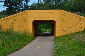
Yellow Tunnel on Skokie Valley Bike Path

The yellowish tunnel on the Skokie Valley Bike Path

This bike trail is in a nice area (Lake Bluff, Lake Forest, Highland Park) but it is really not a scenic trail at all. It runs under a row of power lines, along a major highway (Skokie Highway, Route 41) and through some industrial and commercial areas. I had my camera and my bike GPS computer with me so I have written a trail page article on it and have photographed the trail and posted the pictures.

You can find the Skokie Valley Bike Path Article here.

Keep in mind that, although this bike path runs along the Skokie Hwy it does not go to or through the city of Skokie.

Although this bike path is not very scenic it does still have some good features.  First of all it provides a good connection between the North Shore Bike Trail near Lake Bluff to Highland Park and to the Botanic Gardens, a little past the southern end of the Skokie Valley trail.

Since this bike trail is paved, straight, mostly flat and does not have many intersections that you need to cross, it is also good for speed and a good workout.

I ran out of time on my ride but I wish that I would have had the opportunity to ride through the Botanic Gardens after I reached the southern end of the SV Bike Path (at Lake Cook Road in Highland Park). You can also connect to the North Branch Trail(s) from the Botanic Gardens and continue south from there if you like.

Well this is the time of year to get out and explore new bike paths and I already have my next one selected for later this afternoon. So stay tuned (stop back soon), I will be posting more bike trail ride reports and photos soon!

2012 Bike the Drive Ride Report and Photos

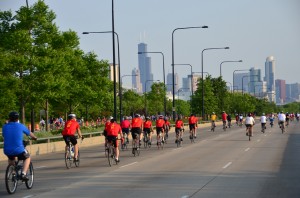
Last Sunday I did the Bike the Drive ride in Chicago for the first time. They close down 30 miles of Lake Shore Drive (Route 41) to automotive traffic for this event and the road is only open to bike riders for about 5 hours.

2012 Bike the Drive, Chicago

2012 Bike the Drive on Lake Shore Drive in Chicago

According to Wikipedia this even has been going on since 2002 so I guess this was the 10th annual Bike the Drive. The main reason that I had not participated in the ride until this year was because the event is so early in the morning. It starts at about 5:30am so for me to get up, get ready and be downtown by that time (I did not want to be late and miss any of the riding time) I had to get up at 2:30am!

OK, aside from the start time, this was an excellent ride and really a lot of fun! I wish they would do this more often (and later in the day 🙂 )

As I had mentioned in one of my previous posts, I just got a new DSLR Camera and I have been chomping at the bit for a good event, like this, to get out and get some good photos. Well, I finally got my chance and I got quite a few good photos at this event. Unfortunately, it was an overcast and cloudy day, which caused some problems, but I was still able to get quite a few good shots. I am still learning how to use this camera so I messed up a lot of the photos too (even though I have uploaded many that were not technically that great).

I wanted to get my Ride Report and the Photos posted on the internet much sooner but it took some time to sort through all the photos, select the good ones that captured the feel of the ride and format and post the photos and report. Since this was such a fun event I wanted to do it right rather than just blasting out a ton of photos as quickly as possible.

Anyway, you can now see the 2012 Bike the Drive Photo Tour and Ride Report here.  I also had my Garmin Edge 800 GPS bike computer on the ride (of course) and I posted the route that we rode also. If you look closely at the map you will see where we branched out off of LSD a little. This was from after the ride when we rode out to the Shedd Aquarium and the planetarium.

New Camera for Better Bike Trail Photos

If you have been to the Bike Trail Pages on the about-bicycles.com website then you know that I have ridden, taken photos (and sometimes videos) and written trail articles on  quite a few bike trails (in the Chicagoland area and in Wisconsin).

New Camera for Bike Trail Photos

New Nikon D5100 for Better Bike Trail Photos

Well, I’ve been using my same old 5MP digital camera since 2005 and it was time for an upgrade so I just purchased a new Nikon DSLR!

I have actually been wanting an SLR camera for much of my adult life (and especially since Digital SLRs became popular) and since I am planning to get out on a lot of new bike trails soon, and there are also some bike events coming up soon ~ and also since the prices on these fantastic and powerful cameras how come down quite a bit now ~ the timing was right and I pulled the trigger on the purchase.

One of the reasons that selected this particular model is because it is a little bit smaller than the full size DSLRs, They classify this camera as a “compact DSLR” although it is still big compared to a point-and-shoot or even one of the new Superzoom cameras (which I was also looking into).

I know from lugging other cameras (and camcorders) out on the bike trails that the smaller sizes are a big plus. This camera is going to be a little more work to lug around (due to the larger size) but I have gotten used to carrying around  photo equipment on my bike and I think I should be able to adjust to it.

The photo above is a front and rear view of the camera that I just bought (of course). OK, so I photoshopped the daisy bike trail picture into the viewfinder. 🙂 I wanted to have a photo of the fully articulating LCD (the flip out view finder screen) so I included both views of the camera.

For my purposes I got this camera with a 18-200mm lens, which is a good multipurpose lens that can be used for close-ups as well as telephoto pics.

I suppose this might look like over-kill for bike trail photos that are mostly going to be viewed on the internet but there are a few good reasons why I upgraded to a high quality DSLR.

First, there have been a handful of times when people who write articles for magazines and hardcopy publications (see this blog post for details) have asked me if they could use photos from this site for their articles. Most of the time the only full size photos that have to send them are from my 5MP camera and often they do not meet the necessary requirements for hard-copy publications.

One of the other reasons for such a major upgrade is just the photo quality. Even if the photos are primarily viewed on the internet, photos from DSLRs are generally just much better quality (even though I do not claim to be a pro photographer (or even close to one) and I can use all the help I can get).

Aside from bike trails, I am also planning to get out to some major bike events this year and wanted to be able to get some quality photos. For example the Bike The Ride event is coming up next weekend (I hope I have the camera by then ~ I ordered through Amazon and just took the free shipping option) if I can get up early enough for this event (and if it’s a nice day).

Also I am really looking forward to the Tour of Elk Grove which is coming up in August. You can find more details on these events at our Special Cycling Events Page.

Anyway, once the new camera arrives and I am able to get out on the bike trails (which will be real soon and I have a large list of trails for this year) and out to the various cycling events, you should start to see some better photos out here!

Green Bay Bike Trail Ride and Photos

This past Sunday (Easter Sunday) I was in Winnetka and had an opportunity to ride the Green Bay Trail and get some new photos. I have ridden the entire Green Bay Trail ~ and even the connecting Robert McClory Trail ~ in the past and the GBT is a really beautiful and scenic bike route so I did not want to pass up the opportunity to ride this trail again.

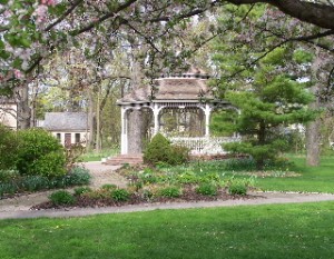
The Gazebo at the Henry J Kalk Park along the Green Bay Trail

The Gazebo at the Henry J Kalk Park along the GBT in Glencoe

I also had a batch of photos of the southern end of the Green Bay Trail (from Glencoe south to Wilmette) that I had lost (!) so I did not have photos of the southern part of the bike trail posted ~ until yesterday that is!

It was a beautiful day on Sunday (a little chilly but still nice) and on the first part of my ride I felt like I was in the Easter Parade! 🙂 There were a lot of people out on the trail ~ riding, walking, jogging ~ in the mid-afternoon.

I started my ride in Winnetka but headed south to the southern end of the trail ~ in Wilmette ~ so I could ride the entire trail. I stopped a lot on my way north for photos (for this site). It is always great to have the photos but it is not nearly as nice, as far as the bike ride goes, to stop all the time for the photos (although I do like taking the photos too).

I rode the entire GBT ~ through Wilmette, Kenilworth, Winnetka, Glencoe, and Highland Park ~ and a little bit of the southern part of the Robert McClory Trail up to Highwood. I stopped at Central Park, in Highland Park ~ on Lake Michigan ~ for a short break and a beautiful view of the lake. Then for the ride back, I just rode (no photos) and it was a really nice ride.

I have had the Green Bay Trail page and photos on this bike site since 2005 but, as I mentioned above, I was missing the southern section (south of Glencoe). Yesterday, I did some updates to the original Green Bay Trail page Here , have added a few photos to the original batch and have added 3 new photo pages of the GBT starting with Green Bay Trail Photo Page 7 (including page 8 and 9).

Back in 2007 I had one of the GBT photos featured in an article in the North Shore Magazine (that photo is on the top of Photo Page 5). I actually think that this round of photos is much better so I maybe if I get lucky I can get another one published in hard-copy form. 🙂

Anyway, the GBT is still a really nice bike trail and an excellent ride. There are also some nice places to head a few blocks east out to Lake Michigan for some excellent scenery. At the time of my ride there was no construction or detours on the trail so it is wide open this year.

For those of you who live in the Chicagoland area (or will be visiting here) I hope you can get out to the GBT at some point.