About Rob

Bike trail and long distance cyclist and publisher of about-bicycles.com

Paul Douglas and Poplar Creek Trails – and the Secret Passage

This weekend I rode the west side of the Paul Douglas Trail (PDT) and the Poplar Creek Trail (PCT) together for a nice 21.6 mile ride! I have noticed that these 2 bike trails are fairly close to each other but only recently have found the secret passage that you can take to go from one trail to the other.
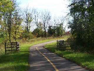
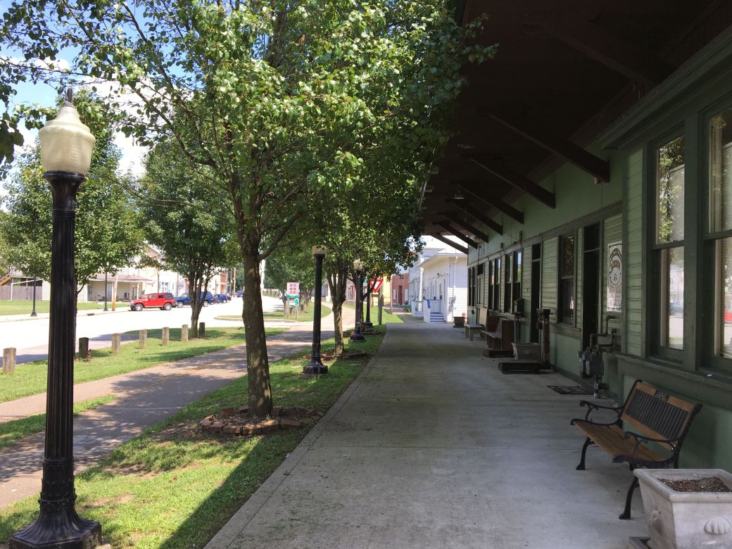
Paul Douglas Trail

Paul Douglas Trail

OK, it might not be that much of a secret (especially now that I am putting it out on the internet for everyone to see) but I have not seen other riders taking this route and never knew about it myself.

Before I talk about my ride, I’ll describe how to connect to either of these trails from the other one. It’s actually a nice route and very safe (when you pay attention). I’ll describe going from PDT to PCT since that is the way that I went/ From the west side of the Paul Douglas Trail where it runs alongside of Freeman Road, there is a stop sign on the road for Lakewood Blvd and the path has blacktop out to the road where you can cross.

Lakewood Blvd is a wide 4 lane divided road with hardly any traffic at all so it is a great bike route (and very safe). You take Lakewood west and a little before Barrington Road is a little commercial area road called Eagle Way (also very little traffic). You go left on to Eagle Way all the way around the Siemens Healthcare building (the road turns to the right after the building) out to where it ends at some parking lots on Central Road. You hop over a small grass median to the parking lot and can cross Central Road here easily. This is near Ginos East Pizza on Barrington and Central Roads.

Next there is a bike path along Barrington Road at this point where you can go along Barrington Road and cross Interstate 90. Getting over the interstate is quite an obstacle, of course, but it is really not that bad here. There are pedestrian signals at each expressway entrance and exit (which you mostly do not even need) and each crossing is one way traffic so once it clears you just ride across. Of course, you do need to pay attention here to avoid becoming road kill!

And for the final stretch after you cross the interstate, you cross Barrington Road at Hassle Road (you really need the pedestrian signal here cause it is really heavy traffic here). Next you take Hassel to Greenspoint Pkwy and go left (this is just hotels and parking lots in this area) and finally cross Higgins, Route 72 and you are at Poplar Creek Trail!

Just a weird little side note but Higgins, Route 72 is a divided highway that has pedestrian signals here. The weird thing is that there is NO BUTTON to cross Route 72 westbound traffic but there is a button for the signal once you get into the median?!?!? Really? It’s like good luck getting across that part but if you make it then you can use the pedestrian signal to get across the rest of it?!? šŸ™‚

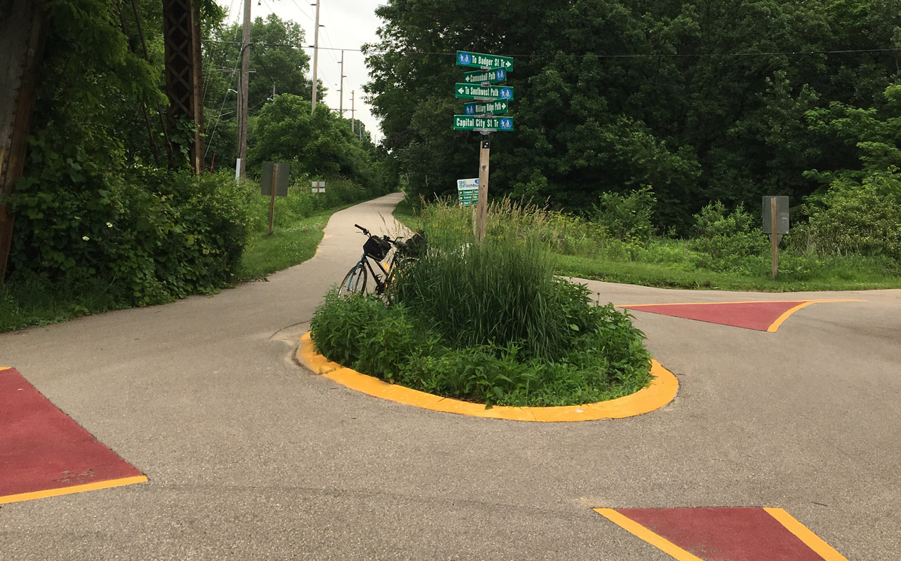
Map of the Secret Passage:

OK, now that I have spent most of the time with this blog post explaining directions for the secret passage between PDT and PCT, here’s a link to the GPS map of my ride on these 2 trails on the Garmin site. The map is probably a lot easier to zoom in on to figure out than my directions above but now you have both. Note that the trail connection is only about 1 mile each way and most of it a pretty easy ride.

Back to the Ride on these 2 Trails:

OK, now that you know how to get from one trail to the other, I’ll give a brief summary of my ride and the conditions of the trails as of this Labor Day 2019 weekend.

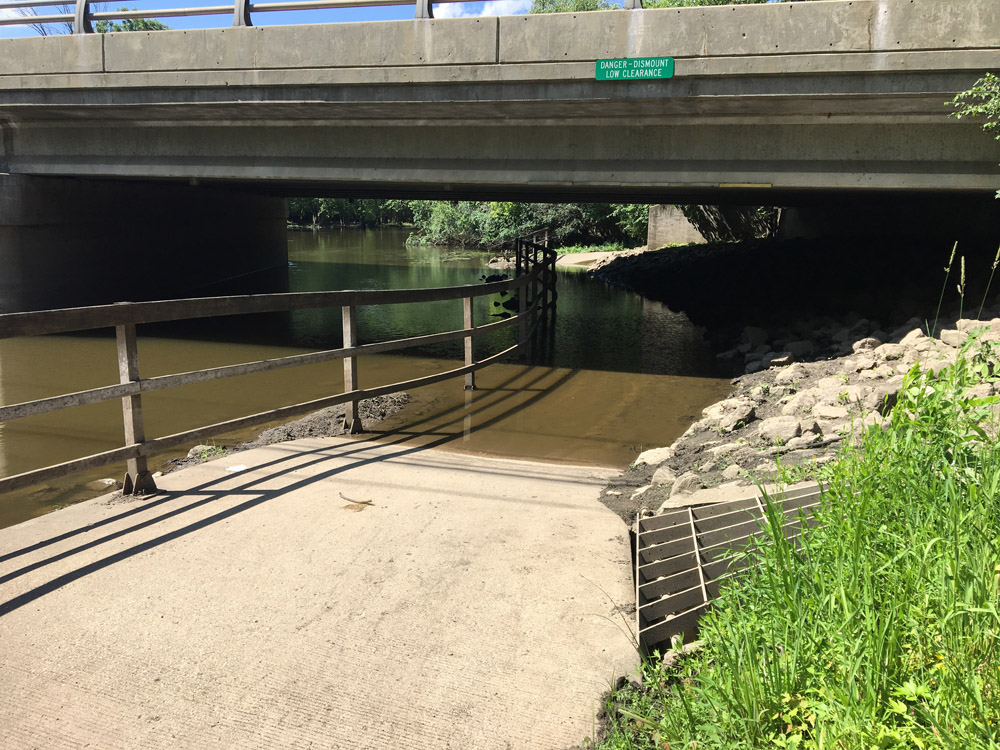
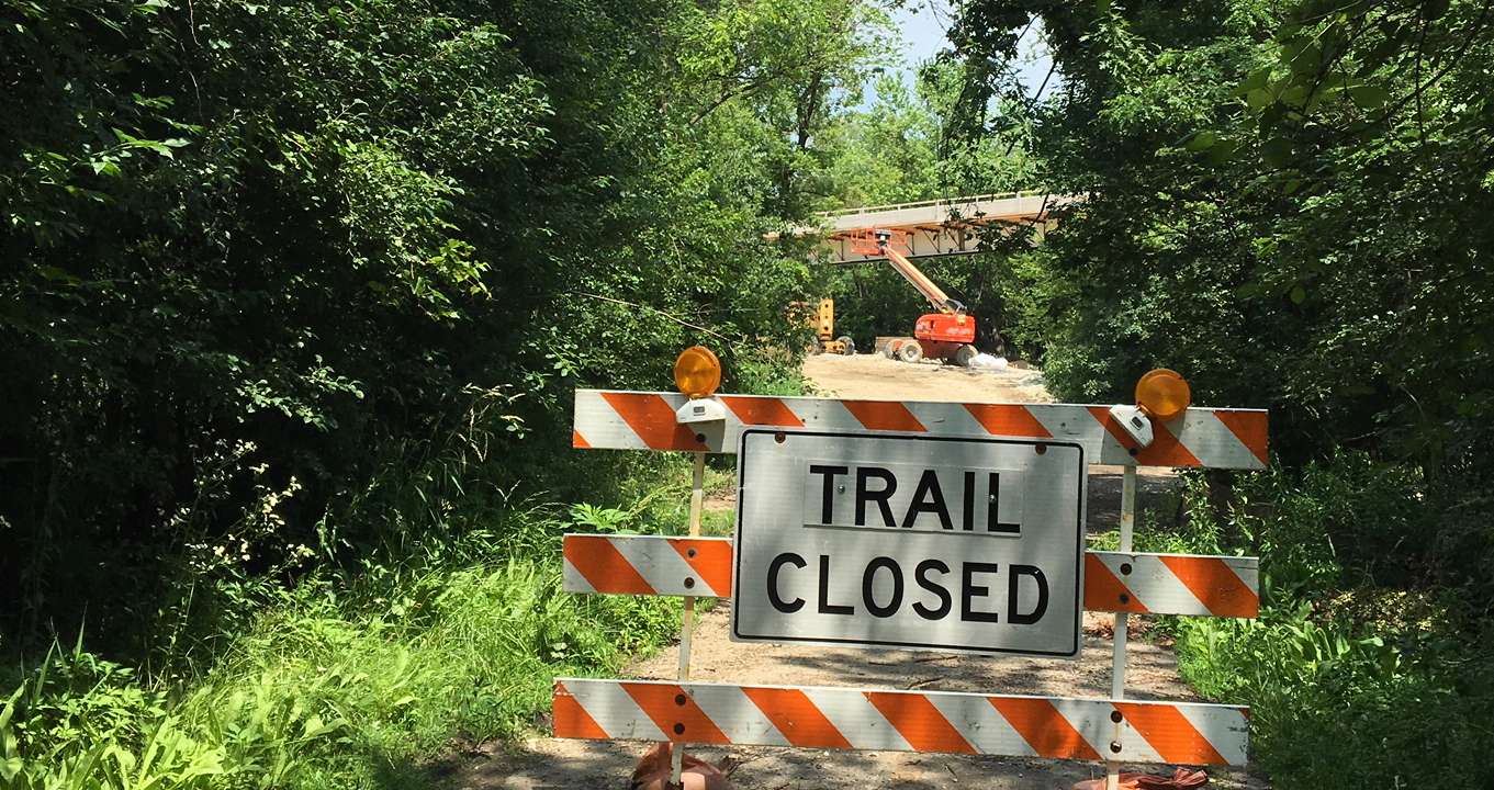
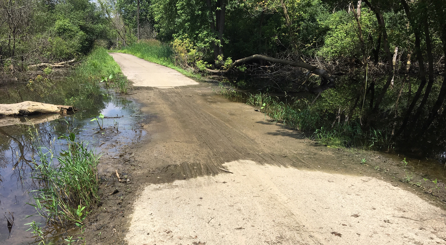
First I rode the Paul Douglas Trail since this one is closer to where I live. I only rode the west side (West of Ela Road) because the trail is closed at this time where it runs along Roselle Road due to construction on the Bike Bridge over Central Road. This should be nice when it is done… but not yet.Ā  Anyway the entire trail east of Ela is open and ridable – Even the usual flood area on the west side along Freeman Road.

Bode Lake PCT

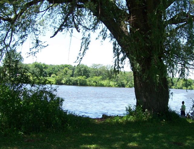
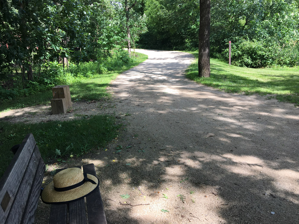
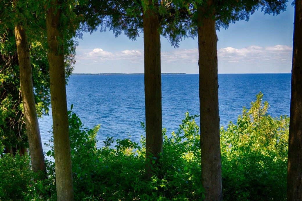
Bode Lake off Poplar Creek Trail

After the trail connection described above, I rode the Poplar Creek Trail. I rode the entire main loop of the PCT which is about 8.8 miles. I haven’t ridden this entire trail in quite a while and noticed that it was a lot hillier than I remembered. It is actually hilly and curvy which I do not like much. The hills are a lot of work to go up and you lose the momentum coming down because it’s too dangerous to go flying downhill on a narrow path with curves.

Still, aside from the hills (and the road crossings) this is a very nice and scenic trail. I particularly like the southern part of the trail where it goes around Bode Lake and the entire main loop is also open and passable at this time.

So that’s it for this particular ride and the current conditions of the PDT and PCT. For more information and photos of these trails see the Paul Douglas Trail pages on this site for that trail and the Poplar Creek Trail pages for that one.

Note: The photos in this article are old and from those pages (since I didn’t take any on my ride this weekend)

Enjoy the Ride! Later!

Rides on the Little Miami Scenic Trail, Ohio

A few weeks ago, towards the end of July, I packed up my bike and myself and drove out to Ohio to ride the Little Miami Scenic Trail (LMST). This was a 5 1/2 hour drive for me so I stayed one night and had 2 rides on the trail. This is an excellent trail!

Morrow Train Station

Morrow Train Station on LMST

I have also just finished posting the ride photos and ride report of this trail on this site. See Little Miami Scenic Trail Photos and Ride Details for more information on this trail.

The photo included here is the old train station in the town of Morrow. To me, this is really a good visual example of what rails-to-trails is about, with the trail right next to the old train station.

The LMST is a 78 mile paved trail that runs fromĀ  Urbana, Ohio (northeast of Dayton) to the outskirts of Cincinnati and mostly follows the Little Miami River.

I rode about 71 miles on my rides but since I have to do round trip rides, to get back to my vehicle, I only covered about 35 miles or less than 1/2 of the trail. I rode from Xenia south to South Lebanon on the 2 rides. The trail was in great shape, fairly flat, not very crowded and just a really nice trail to ride. I would definitely recommend this trail if you get a chance to ride it.

As I mentioned above, there is a lot more information and quite a few photos on the LMST trail pages on this website that I linked to above.

Des Plaines River Trail Conditions – Around Half Day, July 2019


DPRT underpass flooded

DPRT underpass at Route 60

I am finally catching up on the Trail Condition updates here and since I rode on the Des Plaines River Trail (DPRT) yesterday I thought I would do an update right away this time.Ā 

A friend and I rode the DPRT from Route 45 in Half Day north to Route 60 the underpass at Route 60 which was flooded and closed. We also rode a little in Wright Woods so our total ride was a little over 12 miles.

The trail was a little damp on our ride but it was all passable except the underpass at Route 60 as I mentioned. You can go up the hill and cross Route 60 on the road and get back on the trail but we were not going to ride much further on that ride anyway so we just turned around there.

DPRT near Wright Woods

DPRT near Wright Woods

This is a nice shady trail where we rode and very few people were on the trail at the time. The trail is crushed stone but is fairly good condition althought overgrown in places and there are some gravel patches in places. Very easily rideable even with my road bike.

Here is the GPS Map of this ride on the Garmin website.

For a lot more information, photos and ride storiesĀ  on the DPRT or many other trails in the area see the Bike Trails pages on this website.

Paul Douglas Trail Conditions, June 2019

Paul Douglas Trail Closed Section

Trail Closed at Central and Roselle Roads

There are a couple of things to be aware of if you are planning a ride on the Paul Douglas Trail this year (2019).

First, let me mention that I am referring to the trail in north Hoffman Estates that goes around the Paul Douglas Forest Preserve and also connects to the Crabtree Trail. I have this trail listed as the Algonquin Road Trail on this siteĀ  because some of the trail goes along Algonquin Road and that is wat it was referred to before they completed the part that goes all the way around PD Forest Preserve.

The things that you need to be aware of on this trail is that there is a part of the trail, that runs next to Huntington Freeman Road (just north of Lakewood Blvd) that floods quite a bit. and that the trail is closed (June 29, 2019 update) near the intersection of Central Road and Roselle Road.

Paul Douglas Flood area

Paul Douglas Flood section, June 29, 2019

The good news is that the flood area (along Freeman Road on the west side of the park) is not flooded at this time. This area was flooded up until a week or 2 ago (early June) but was not flooded on my last ride on June 29, 2019. The photo here shows where the flood area is a little wet and muddy but not flooded.

I don’t know if this just dried up on its own or if they pumped it out like I saw them doing last year around this time (it was much worse last year though). Anyway, it is easily passable now. Even if it is flooded it is just a short (my 1/4 mile) detour on Huntington Freeman Road that does not have a lot of traffic anyway.

The other obstacle is that the trail is closed down near Central and Roselle roads. The reason for this is that they are actually building a bike path bridge over Central Road here. If you look at the first photo that I included here (with the trail closed sign) you can see the bike path bridge in the background.

I think that the bike trail bridge over Central Road may be nice when it is done but then you still have to cross over Interstate 90 (there is a pedestrian path over the bridge) and cross a bunch of lanes of traffic (where traffic is getting off of I90) after that. Once you get past all of that there are some trails but I’m not sure if it is the best riding area right there.

Anyway, the trail around Paul Douglas Forest Preserve is still a pretty nice trail and much less crowded than other longer trails in the area (like Busse Woods). The PD trail is all paved but it is a little hilly in places.

If you want to extend your ride on this trail you can follow the bikepath northwest (right next to Algonquin Road) to the Crabtree Trail through the Crabtree Nature area or preserve. I don’t care for that route that much (since so much of it is along Algonquin Road). Instead I like to take a little side trip down Lakewood Blvd. and back which is a really nice, on a barely used 4 lane road and is a nice 2 mile extension which you can see on my Garmin GPS Map of one of recent my rides.

Here is one of my latest rides on the Paul Douglas Trail with the Lakewood Blvd. extension to the ride. Map of my Paul Douglas Ride on the Garmin website.

If you are looking for more details on these trails or many other trails in the area, you can search this blog orĀ  just go to the Bike Trails Page on this website for a lot of details and photos of the trails.

Fox River Trail Conditions, Crystal Lake to Elgin

I am continuing my Bike Trail Conditions updates for 2019 with the Fox River Trail conditions between Crystal Lake and Elgin. Technically, the northern part of this ride is on theĀ McHenry County Prairie Trail (from Algonquin to Crystal Lake)Ā  but the majority of this ride is on the Fox River Trail (FRT) so that is how I am referring to this ride as the Fox River Trail ride in this post.

First of all, at the time of my ride(s), June of 2019, there are no problems on this part of the trail. The only minor issue is that is a very short detour just south of Algonquin at Botz Road where they are building a new bridge over the river.

I am not familiar with what they are doing with the bridge in this area, it looks like maybe Botz Road will cross the river here, but there is a short jog-jog detour of the FRT here. It is not a problem at all and the detour is a paved trail but it is worth mentioning.

It is also good to know that the rest of the trail in this area is in good condition since the Fox River Trail does have floods at times – but the this section is fine now (and a really nice ride).

I rode a 50 miles on this section of the trail(s) but this part of the trail is actually about 14 miles one way. This is from Crystal Lake at Rankow and Pyott roads (across from the airport) to the park and library area just before the busy roads in Elgin (I did not go through Elgin). I went back and forth on this part of the trail to get the 50 miles.

Here is the GPS Map of my ride on the Garmin website. My Fox River Trail Ride on the Garmin website.

If you are looking for more details on these trails or many other trails in the area, you can search this blog orĀ  just go to the Bike Trails Page on this website for a lot of details and photos of the trails.

Bike Trail Conditions, Busse Woods, Old Plank Road and Green Bay

It’s been a while since I have updated this blog with bike trail conditions and recently I became more aware of how important that is since I have not found a centralized website with really good and up to date bike trail conditions (preferably from riders).

I am going to post an update here for the 3 trails mentioned in the Blog Title: The Busse Woods Trail, the Old Plank Road Trail and the Green Bay Trail. I have ridden all of these trails in June of this year (2019). So these updates are pretty recent and I am getting the trail conditions updates in before the July 4th weekend :-).

OK, first of all the reason that I am including these 3 trails together in one post because these are the easiest trails to update! Why? Well because there are no problems or detours on any of these trails (in the sections that I have ridden) and these trails do not typically have too many issues anyway.

As for the sections of these trails that I have ridden (this year, 2019), I am including links to my Garmin GPS maps of each my rides, in addition to a brief description of the sections that I have ridden.

On the Busse Woods Trail, I have ridden the entire 7.3 mile Red Loop (BTW: this is a really beautiful ride (but it gets really crowded so it is best to go at off times)). The Purple section (including a side trip to the bridge over 53/290) and the Black section that goes out to Golf Road. My ride was a little over 15 miles and this is all paved. Here is the Garmin GPS map of my latest ride there: My Busse Woods Ride on GarminĀ  website. As I mentioned above there are no issues with this trail.

As for the Old Plank Road Trail, I have ridden from New Lenox to Chicago Heights (36 miles both ways and all paved). Here is the Garmin GPS map of my latest ride: My Old Plank Road Trail Ride on Garmin website.Ā  AlsoĀ no issues with this trail.

And finally (for this post), The Green Bay Trail. I have ridden this trail from Highland Park to Wilmette and then out to Gillson Beach on Lake Michigan back in early June (22 miles and mostly crushed stone). There were some puddles and wet spots on parts of this trail but nothing that would be a problem. Here is my Garmin GPS map of this ride: My Green Bay Trail Ride on Garmin website.

I realized that even the updates that I post here are helpful since it can be difficult to get trail condition updates on the internet. I have not found a centralized source (website) that has really good up to date conditions. I was recently looking for updates for a website visitor that sent me an email looking for updates on the Jane Adams Trail and the Badger State Trail. I have ridden both of these trails but not recently so I could not help a lot.

I was also looking for updates on the Military Ridge Trail in Wisconsin andĀ I did find that the State of Wisconsin had some pretty good updates on their state trails but I was not sure exactly how current they were.

Coming up next: I will be posting trail condition updates for the Fox River Trail and the Paul Douglas Trail. I should probably do these blog posts periodically, as I ride the trails, rather than all at once but I got a little behind and still wanted to get this information out here.

By the way, if you are looking for more details on any of the trails mentioned in this post, you can search this blog orĀ  just go to the Bike Trails Page on this website for a lot of details and photos of the trails.

Rode 5 New Trails in One Day!

Back in June a friend and I decided that we would ride the Military Ridge Trail west from near Madison, Wisconsin.

Bike Trail Roundabout, Madison

We only got about 3 miles or so and ran into a highway underpass that was badly flooded from the many storms that we had at that time.

So we turned around and headed east on the Military Ridge Trail instead. This turned out to be a great ride and after a few miles we came to the Bike Trail Roundabout intersection shown in the photo here.

I had never seen anything like this before. Actually I do not think that there are many of these bike trail roundabouts in this country! When I did a Google search I saw one in Holland, of course but that is a huge biking country and just about everyone there rides bikes.

Anyway, I believe that the Bike Trail Roundabout is in Madison but it is right where the towns of Madison and Fitchburg meet so it could be in Fitchburg.

The Bike Trail Roundabout is like a regular automobile roundabout, or traffic circle except it is an intersection of bike trails. In this case it is where 5 different bike trails meet.Ā  The trails are 1) The Badger State Trail, 2) The Cannonball Path, 3) The Southwest Path, 4) The Military Ridge Trail and 5) The Capital City Trail. WOW!

So even though our ride west on the Military Ridge Trail was cut short it was probably more interesting discovering all of these trails anyway.

Our ride was primarily on the Military Ridge Trail and the Cannonball Trail but we also rode a little ways on the Badger State Trail and did very short rides on the Capital City Trail and another trail that we found in Verona, Wisconsin called the Ice Age Trail.

I didn’t really know what a great biking area Madison is and that there were so many good trails there. I’m sure I will be going back to ride more of them.

I did not get a lot of photos of these trails but I did get some and I just completed the trail pages on this website for these trails.

See The Military Ridge Trail pages and The Cannonball Path pagesĀ , on this website, for the photos and ride stories for these 2 trails. I also took a Google Photo Sphere photo at the Bike Roundabout which has a link on these bike trail pages also.

Door County Bike Trails

I had an opportunity to ride some of the main bike trails in Door County, Wisconsin last month (the first week of June) and I have just completed the Bike Trail PageĀ  updates on this site with New Photos and 2 New Videos.

Door County Sunset Trail

Door County Sunset Trail

The 2 trails that I rode were the Ahnapee Trail and the Peninsula State Park (PSP) Sunset Trail. There were already trail pages and photos for these 2 trails on this site but they were from 2003 so I gave them an update with some really good photos and the videos too.

I really liked both of these trails. The Ahnapee trail is much longer than the Sunset Trail but you get a good workout with the hills on the Sunset Trail even though that one is a little less than 10 miles. The Sunset Trail also has some nice views of the various bays from Lake Michigan.

Although I really enjoyed the rides on these trails, I also brought my Nikon DSLR camera and iPhone for photos and videos and I rode with Dale Kiffel who also had his camera and takes excellent photos (like the Sunset Trail one in this post).

In addition to the still photos and videos I also took some panoramic photos with my phone and even did a few 3D spherical photos for Google Maps Street View (with the Street View app on my phone) so I was really workin the trail (in addition to having fun)! šŸ™‚

You can see the updates, all the new photos, the Street View photos and the 2 videos from the updated pages below:

Ahnapee Trail Photos, Videos and Updates

PSP Sunset Trail Photos, Videos and Updates

I have also included quite a few nice Door County Sunset Photos with the PSP Sunset Trail pages. They were not actually taken from the trail, but were from the same area after our rides and fit the Sunset Trail theme pretty well too.

I hope you enjoy the articles, photos and videos…

Bike Broke Break

Bike Chain and Spindle

New Chain and Spindle

I took a little unplanned break from bike riding last week. I went out for one of my usual rides earlier in the week and yep, my bike broke. I went to shift gears and snap! the rear shifter cable broke.

So I brought it into my Local Bike Shop (LBS) and they talked me into doing both shifter cables, the chain and the spindle (the thing with all the gears by the back wheel). I thought that my chain was in bad shape due to all the miles that I’ve put on and I know that that messes upthe gears too so that’s why I went for it.

Anyway, they said it would take 5 to 7 days. In peak riding season! Oh no! But then it ended up only taking 2 days. So now I am back in the saddle again with new shifter cables, a new chain and new back gears and only a few forced no riding days.

My chain in the photo will never look that clean and new again. How exciting, right?!? With the new chain and spindle the gears shift WAY better than they did before and that is very noticable so at least it was better than just getting it back working again like before.

Springtime – Flooding and Construction

Well spring is here and it feels great to get out on 2 wheels and ride again! Now that I have been out to my main trail (the Paul Douglas Trail) a few times this year I have come across a number of obstacles that I wanted to mention.

Flooding on bike trail

Flooding again on Paul Douglas Trail

The first obstacle that I wanted to mention is the flooding in the usual place on the Paul Douglas Trail. This isĀ on the west side of the trail along Huntington/Freeman road.

You can get around this pretty easily by going out on the road for about 1/4 mile then back to the trail again but it is getting a little old and I don’t know why they are not able to resolve the problem.

Normally if the water is not too deep I just ride through it. In this case there is also a lot of debris like branches and piles of sticks and I did not want to try to ride over the debris or take the chance of running into something in the water and end up having to stop and get soaked.

The road – Hunting/Freeman – is not all that busy so I don’t mind too much but I would rather be able to just stay on the trail.

The next obstacle on the Paul Douglas Trail is that it is still closed east of Ela on the south side of the trail where they are doing construction on the new tollway ramp at Central. There is no practical way around this. You could go north on Ela to get to the other side of the trail to do a loop of this part of the trail but I usually just turn around because I prefer trails to roads and Ela is 2 lanes and has more traffic than I like to deal with.

One interesting thing is that there are a few signs that say that this part of the trail will be “Closed Until Summer 2018“.Ā  Well that is nice to know but a little vague. Does this mean until the start of the summer, some time during the summer or their deadline is by the end of summer? I guess we’ll just have to wait and see when that part of the trail opens up again.

Those are the main obstacles on the Paul Douglas Trail that I am aware of (I don’t usually ride the northwest extension of the trail that goes into Crabtree Nature Preserve so I don’t have an update on that part of the trail at this time).

I also have some additional construction related obstacles just getting to the trail myself from my neighborhood but I have found ways around those. The only other thing about this trail that I wanted to mention is that they burned down the brush on the northwest part of the mail loop (near Algonquin and Huntington/Freeman) and that looks pretty crappy at this time.

I’m sure that will grow back fairly soon and I think the idea is that it will be healthier and come in better than it was before but I guess we will just have to wait for that to happen.

Well that’s it for the Paul Douglas Trail updates for now (and I thought that this was going to be a quick update!).

Enjoy the great riding weather that we have coming!